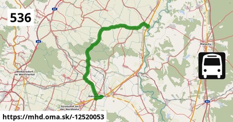
Zastávky na linke
Dürnkrut Bahnhof po ¤, Dürnkrut Schulen po 1,00 km ¤, Dürnkrut Badsiedlung po 1,82 km ¤, Waidendorf Am Alten Friedhof po 3,9 km ¤, Velm-Götzendorf Vorstadt po 5,9 km ¤, Velm-Götzendorf Feldstraße po 6,2 km ¤, Velm-Götzendorf Ortsmitte po 7,0 km ¤, Velm-Götzendorf Hauptstraße 66/73 po 7,7 km ¤, Velm-Götzendorf Hauptstraße 18/23 po 8,4 km ¤, Spannberg Neugasse po 10,7 km ¤, Spannberg Hauptplatz po 11,3 km ¤, Spannberg Matzner Straße po 11,8 km ¤, Spannberg Sportplatz po 12,2 km ¤, Matzen Hauptplatz po 19 km ¤, Matzen Schule po 20 km ¤, Reyersdorf Kirche po 23 km ¤, Reyersdorf Hauptstraße po 23 km ¤, Schönkirchen Schloss po 24 km ¤, Schönkirchen Berggasse po 25 km ¤, Gänserndorf Schönkirchner Straße po 27 km ¤, Gänserndorf Rathausplatz po 27 km ¤, Gänserndorf Bahnhof po 29 km ¤Zastávky popri linke:, 1 z 2
Dürnkrut Bahnhof po ¤, Dürnkrut Schulen po 1,00 km ¤, Dürnkrut Schulen po 1,01 km ¤, Dürnkrut Badsiedlung po 1,78 km ¤, Dürnkrut Badsiedlung po 1,82 km ¤, Waidendorf Am Alten Friedhof po 3,9 km ¤, Waidendorf Am Alten Friedhof po 3,9 km ¤, Velm-Götzendorf Vorstadt po 5,9 km ¤, Velm-Götzendorf Vorstadt po 5,9 km ¤, Velm-Götzendorf Feldstraße po 6,2 km ¤, Velm-Götzendorf Feldstraße po 6,2 km ¤, Velm-Götzendorf Ortsmitte po 7,0 km ¤, Velm-Götzendorf Ortsmitte po 7,0 km ¤, Velm-Götzendorf Hauptstraße 66/73 po 7,7 km ¤, Velm-Götzendorf Hauptstraße 66/73 po 7,7 km ¤, Velm-Götzendorf Hauptstraße 18/23 po 8,4 km ¤, Velm-Götzendorf Hauptstraße 18/23 po 8,5 km ¤, Spannberg Neugasse po 10,7 km ¤, Spannberg Neugasse po 10,7 km ¤, Spannberg Hauptplatz po 11,3 km ¤, Spannberg Matzner Straße po 11,8 km ¤, Spannberg Matzner Straße po 11,8 km ¤, Spannberg Sportplatz po 12,2 km ¤Zastávky popri linke:, 2 z 2
Spannberg Sportplatz po 12,2 km ¤, Matzen Hauptplatz po 19 km ¤, Matzen Hauptplatz po 19 km ¤, Matzen Schule po 20 km ¤, Reyersdorf Kirche po 23 km ¤, Reyersdorf Kirche po 23 km ¤, Reyersdorf Hauptstraße po 23 km ¤, Reyersdorf Hauptstraße po 23 km ¤, Schönkirchen Schloss po 24 km ¤, Schönkirchen Schloss po 24 km ¤, Schönkirchen Berggasse po 25 km ¤, Schönkirchen Berggasse po 25 km ¤, Gänserndorf Schönkirchner Straße po 27 km ¤, Gänserndorf Schönkirchner Straße po 27 km ¤, Gänserndorf Rathausplatz po 27 km ¤, Gänserndorf Rathausplatz po 27 km ¤, autobusová zastávka po 27 km ¤, autobusová zastávka po 27 km ¤, Gänserndorf Villagasse po 29 km ¤, Gänserndorf Bahnhof po 29 km ¤, Gänserndorf Bahnhof po 29 km ¤, Gänserndorf Bahnhof po 29 km ¤prestupné linky:
EuroCity Wien – Warszawa po 203 m ¤, EN 40406: Wien - Praha po 203 m ¤, REX1: Wiener Neustadt = > Břeclav po 203 m ¤, railjet Villach = > Prag po 203 m ¤, railjet Prag = > Villach po 208 m ¤, NJ 457: Berlin = > Graz po 208 m ¤, EN 407: Praha - Wien po 208 m ¤, REX1: Břeclav = > Wiener Neustadt po 208 m ¤, EuroCity Warszawa – Wien po 208 m ¤, Bus 537: Matzen Schule = > Ebenthal Stillfrieder Straße po 20 km ¤, Bus 532: Schönkirchen Tannengasse = > Schönkirchen Volksschule po 24 km ¤, Bus 524: Strasshof Industriestraße = > Gänserndorf Busbahnhof po 28 km ¤Má spoločné úseky s linkami:
Bus 565: Mistelbach Bahnhof = > Dürnkrut Bahnhof po 0,90 km ¤ , Bus 536: Matzen Schule = > Dürnkrut Bahnhof po 0,90 km ¤ , Bus 565: Dürnkrut Bahnhof = > Niedersulz Museumsdorf = > Mistelbach Bahnhof po 0,90 km ¤ , Bus 537: Dürnkrut Bahnhof = > Prottes Volksschule po 0,90 km ¤ , Bus 565: Dürnkrut Bahnhof = > Mistelbach Bahnhof po 0,90 km ¤ , Bus 565: Dürnkrut Bahnhof = > Niedersulz Kirche po 0,90 km ¤ , Bus 537: Dürnkrut Bahnhof = > Ebenthal Florianiplatz po 0,90 km ¤ , Bus 537: Matzen Schule = > Dürnkrut Bahnhof po 0,90 km ¤ , Bus 537: Gänserndorf Bahnhof = > Dürnkrut Bahnhof po 0,90 km ¤ , Bus 537: Ebenthal Florianiplatz = > Dürnkrut Bahnhof po 0,90 km ¤ , Bus 564: Zistersdorf Schloßplatz = > Drösing Bahnhof (ohne Drösing Kaiser-Josef-Platz) po 0,90 km ¤ , Bus 564: Mistelbach Hauptplatz = > Mistelbach Alleegasse = > Drösing Bahnhof po 0,90 km ¤ , Bus 564: Mistelbach Bahnhof = > Dürnkrut Bahnhof po 0,90 km ¤ , Bus 564: Mistelbach Bahnhof = > Dürnkrut Bahnhof (ohne Mistelbach Hauptplatz) po 0,90 km ¤ , Bus 564: Mistelbach Bahnhof = > Drösing Bahnhof po 0,90 km ¤ , Bus 564: Mistelbach Bahnhof = > Mistelbach Wirtschaftspark = > Drösing Bahnhof po 0,90 km ¤ , Bus 564: Mistelbach Bahnhof = > Drösing Bahnhof (ohne Mistelbach Hauptplatz, Drösing Kaiser-Josef-Platz) po 0,90 km ¤ , Bus 564: Mistelbach Bahnhof = > Drösing Bahnhof (ohne Großinzersdorf) po 0,90 km ¤ , Bus 565: Dürnkrut Bahnhof = > Spannberg Hauptplatz po 0,90 km ¤ , Bus 564: Dürnkrut Bahnhof = > Wilfersdorf bei Mistelbach Wirtschaftspark = > Mistelbach Hauptplatz = > Mistelbach Bahnhof po 0,90 km ¤ , Bus 564: Dürnkrut Bahnhof = > Wilfersdorf Wirtschaftspark = > Mistelbach Bahnhof po 0,90 km ¤ , Bus 564: Drösing Bahnhof = > Zistersdorf Kaiserstraße (ohne Großinzersdorf) po 0,90 km ¤ , Bus 564: Drösing Bahnhof = > Mistelbach Bahnhof po 0,90 km ¤ , Bus 564: Drösing Bahnhof = > Drösing Kaiser-Josef-Platz = > Wilfersdorf bei Mistelbach Wirtschaftspark = > Mistelbach Bahnhof po 0,90 km ¤ , Bus 564: Drösing Bahnhof = > Drösing Kaiser-Josef-Platz = > Mistelbach Bahnhof po 0,90 km ¤ , Bus 564: Drösing Bahnhof = > Mistelbach Bahnhof (ohne Kettlasbrunn) po 0,90 km ¤ , Bus 565: Niedersulz Kirche = > Dürnkrut Bahnhof po 0,90 km ¤ , Bus 565: Mistelbach Bahnhof = > Niedersulz Museumsdorf = > Dürnkrut Bahnhof po 0,90 km ¤ , Bus 573: Hollabrunn Internat = > Altlichtenwarth Neusiedler Straße po 6,2 km ¤ , Bus 573: Altlichtenwarth Neusiedler Straße = > Hollabrunn Internat po 7,9 km ¤ , Bus 565: Mistelbach Bahnhof = > Ebenthal = > Dürnkrut Bahnhof po 7,9 km ¤ , Bus 565: Mistelbach Bahnhof = > Spannberg Hauptplatz po 11,3 km ¤ , Bus 536: Gänserndorf Bahnhof = > Dürnkrut Bahnhof po 12,6 km ¤ , Bus 536: Gänserndorf Bahnhof = > Spannberg Hauptplatz po 12,6 km ¤ , Bus 534: Matzen Schule = > Hohenruppersdorf Marktplatz po 19 km ¤ , Bus 534: Matzen Schule = > Obersulz Ortsmitte po 19 km ¤ , Bus 534: Matzen Schule = > Zistersdorf Schloßplatz po 19 km ¤ , Bus 530: Wolkersdorf Bahnhof = > Gänserndorf Bahnhof po 20 km ¤ , Bus 530: Gänserndorf Bahnhof = > Auersthal Europa-Siedlung = > Wolkersdorf Wiener Straße po 20 km ¤ , Bus 537: Gänserndorf Bahnhof = > Matzen Schule po 20 km ¤ , Bus 537: Gänserndorf Bahnhof = > Ebenthal Stillfrieder Straße po 20 km ¤ , Bus 537: Gänserndorf Bahnhof = > OMV = > Ebenthal Stillfrieder Straße po 20 km ¤ , Bus 534: Gänserndorf Bahnhof = > Zistersdorf Schloßplatz po 20 km ¤ , Bus 530: Gänserndorf Bahnhof = > Wolkersdorf Wiener Straße po 20 km ¤ , Bus 530: Wolkersdorf Wiener Straße = > Gänserndorf Bahnhof po 20 km ¤ , Bus 534: Raggendorf Hauptstraße = > Matzen Schule po 20 km ¤ , Bus 530: Gänserndorf Bahnhof = > Wolkersdorf Wiener Straße po 20 km ¤ , Bus 530: Raggendorf Busbahnhof = > Gänserndorf Bahnhof po 20 km ¤ , Bus 530: Gänserndorf Bahnhof = > Auersthal Europa-Siedlung = > Wolkersdorf Wiener Straße po 20 km ¤ , Bus 535: Mistelbach Bahnhof = > Gänserndorf Bahnhof po 23 km ¤ , Bus 536: Spannberg Hauptplatz = > Reyersdorf Hauptstraße po 23 km ¤ , Bus 536: Reyersdorf Kirche = > Spannberg Hauptplatz po 23 km ¤ , Bus 535: Gänserndorf Bahnhof = > Mistelbach Bahnhof po 23 km ¤ , Bus 532: Matzen Schule = > Strasshof Lehargasse po 23 km ¤ , Bus 535: Gänserndorf Bahnhof = > Mistelbach Bahnhof po 23 km ¤ , Bus 531: Wolkersdorf Volksschule = > Reyersdorf Hauptstraße po 23 km ¤ , Bus 532: Matzen Schule = > Auersthal Schulen = > Strasshof Lehargasse po 23 km ¤ , Bus 531: Auersthal Schulen = > Reyersdorf Hauptstraße po 23 km ¤ , Bus 531: Wolkersdorf Mittelschule = > Reyersdorf Hauptstraße po 23 km ¤ , Bus 531: Wolkersdorf Gymnasium = > Auersthal Europa-Siedlung = > Gänserndorf Bahnhof po 23 km ¤ , Bus 531: Auersthal Schulen = > Schönkirchen Volksschule = > Gänserndorf Bahnhof po 23 km ¤ , Bus 531: Auersthal Schulen = > Gänserndorf Bahnhof po 23 km ¤ , Bus 105: St. Pölten Landhaus Nord = > Gänserndorf Bahnhof po 23 km ¤ , Bus 531: Wolkersdorf Gymnasium = > Gänserndorf Bahnhof po 23 km ¤ , Bus 531: Gänserndorf Busbahnhof = > Auersthal Schulen po 23 km ¤ , Bus 532: Schönkirchen Volksschule = > Reyersdorf Hauptstraße = > Schönkirchen Tannengasse po 23 km ¤ , Bus 532: Schönkirchen Volksschule = > Reyersdorf Hauptstraße = > Strasshof Lehargasse po 23 km ¤ , Bus 532: Strasshof Lehárgasse = > Matzen Schule po 24 km ¤ , Bus 532: Schönkirchen Volksschule = > Schönkirchen Tannengasse po 24 km ¤ , Bus 537: Gänserndorf Bahnhof = > Ebenthal Stillfrieder Straße (ohne Matzen) po 27 km ¤ , Bus 551: Gänserndorf = > Groß-Enzersdorf po 27 km ¤ , Bus 525: Gänserndorf Bahnhof = > Gänserndorf Volksschule po 27 km ¤ , Bus 534: Hohenruppersdorf Gemeindeamt = > Gänserndorf Siebenbrunner Straße po 27 km ¤ , Bus 551: Groß Enzersdorf Volksschule = > Gänserndorf Busbahnhof po 27 km ¤ , Bus 551: Groß-Enzersdorf Auvorstadt = > Gänserndorf Busbahnhof po 27 km ¤ , Bus 524: Strasshof Werndlgasse = > Gänserndorf Busbahnhof po 27 km ¤ , Bus 524: Strasshof Kleistgasse = > Gänserndorf Bahnhof po 28 km ¤ , Bus 524: Gänserndorf Hans-Kudlich-Gasse = > Strasshof Werndlgasse po 28 km ¤ , Bus 525: Gänserndorf Lagerhausstraße = > Gänserndorf Volksschule po 28 km ¤ , Bus 525: Gänserndorf Bockfließer Weg = > Gänserndorf Volksschule po 28 km ¤ , Bus 524: Gänserndorf Bahnhof = > Strasshof Werndlgasse = > Gänserndorf Süd Habichtweg po 28 km ¤ , Bus 524: Strasshof Werndlgasse = > Gänserndorf Bahnhof po 28 km ¤ , Bus 524: Strasshof Grenzstraße 3 = > Gänserndorf Bahnhof po 28 km ¤ , Bus 525: Gänserndorf Volksschule = > Gänserndorf Rathausplatz po 28 km ¤ , Bus 546: Gänserndorf = > Markthof = > Stopfenreuth po 28 km ¤ , Bus 546: Gänserndorf = > Stopfenreuth po 28 km ¤ , Bus 521: Gänserndorf = > Deutsch Wagram (nicht über Helmahof Andreas-Reischek-Gasse) po 28 km ¤ , Bus 537: Dürnkrut Bahnhof = > Matzen Schule = > Gänserndorf Bahnhof po 28 km ¤ , Bus 534: Zistersdorf Schloßplatz = > Gänserndorf Bahnhof po 28 km ¤ , Bus 536: Spannberg Hauptplatz = > Gänserndorf Busbahnhof po 28 km ¤ , Bus 545: Gänserndorf = > Orth an der Donau po 28 km ¤ , Bus 545: Gänserndorf = > Haringsee po 28 km ¤ , Bus 521: Gänserndorf = > Deutsch Wagram po 28 km ¤ , Bus 545: Gänserndorf = > Orth an der Donau Biotech Campus = > Orth an der Donau po 28 km ¤ , Bus 525: Gänserndorf Volksschule = > Gänserndorf Flurgasse po 29 km ¤ , Bus 528: Gänserndorf Hans-Kudlich-Gasse = > Baumgarten/March Ortsmitte (ohne Halt in Gänserndorf Schillergasse, Grillparzergasse) po 29 km ¤ , Bus 537: Ebenthal Stillfrieder Straße = > OMV = > Gänserndorf Bahnhof po 29 km ¤ , Bus 528: Gänserndorf Hans-Kudlich-Gasse = > Weikendorf Volksschule (ohne Halt in Gänserndorf Schillergasse, Grillparzergasse) po 29 km ¤ , Bus 528: Gänserndorf Hans-Kudlich-Gasse = > Baumgarten/March Ortsmitte po 29 km ¤ , Bus 537: Ebenthal Stillfrieder Straße = > Gänserndorf Bahnhof po 29 km ¤ , Bus 526: Ollersdorf Tallesbrunner Straße = > Gänserndorf Bbf po 29 km ¤ , Bus 526: Angern an der March Marktplatz = > Gänserndorf Bbf po 29 km ¤ , Bus 526: Angern an der March Bahnhof = > Gänserndorf Bbf (ohne Dörfles) po 29 km ¤ , Bus 526: Gänserndorf Hans-Kudlich-Gasse = > Ebenthal Stillfrieder Straße po 29 km ¤ , Bus 526: Gänserndorf Hans-Kudlich-Gasse = > Angern/March Bahnhof (ohne Dörfles) po 29 km ¤ , Bus 528: Gänserndorf Hans-Kudlich-Gasse = > Markthof Nr. 10 po 29 km ¤ , Bus 546: Stopfenreuth = > Gänserndorf po 29 km ¤ , Bus 524: Gänserndorf Volksschule = > Strasshof Werndlgasse po 29 km ¤ , Bus 524: Gänserndorf Volksschule = > Gänserndorf Süd Eschenweg = > Strasshof Werndlgasse po 29 km ¤ , Bus 528: Weikendorf Volksschule = > Gänserndorf Bahnhof po 29 km ¤ , Bus 528: Marchegg Fünfhaus = > Gänserndorf Bahnhof po 29 km ¤ , Bus 528: Oberweiden Gemeindeamt = > Gänserndorf Busbahnhof po 29 km ¤ , Bus 528: Zwerndorf Ortsmitte = > Gänserndorf Bahnhof po 29 km ¤ , Bus 528: Markthof Nr. 10 = > Gänserndorf Busbahnhof po 29 km ¤ , Bus 531: Gänserndorf Bahnhof = > Auersthal Schulen po 29 km ¤ , Bus 531: Gänserndorf Bahnhof = > Wolkersdorf Mittelschule po 29 km ¤ , Bus 528: Gänserndorf Bahnhof = > Weikendorf Volksschule po 29 km ¤ , Bus 528: Gänserndorf Bahnhof = > Marchegg Fünfhaus po 29 km ¤ , Bus 528: Gänserndorf Bahnhof = > Zwerndorf Ortsmitte po 29 km ¤ , Bus 531: Gänserndorf Bahnhof = > Wolkersdorf Bahnhof po 29 km ¤ , Bus 105: Gänserndorf Bahnhof = > St. Pölten Hauptbahnhof Nord po 29 km ¤ , Bus 537: Dürnkrut Bahnhof = > Gänserndorf Bahnhof po 29 km ¤ , Bus 521: Deutsch-Wagram = > Gänserndorf po 29 km ¤ , Bus 545: Orth an der Donau = > Gänserndorf po 29 km ¤ , Bus 524: Gänserndorf Volksschule = > Gänserndorf Bahnhof po 29 km ¤ , Bus 521: Deutsch-Wagram = > Gänserndorf Bahnhof po 29 km ¤ , Bus 521: Deutsch-Wagram = > Gänserndorf Bahnhof po 29 km ¤ , Bus 545: Haringsee = > Gänserndorf po 29 km ¤Trasa vedie cez obce
Gemeinde Matzen-Raggendorf: 5,6 km (19 %), Gemeinde Spannberg: 5,4 km (18.6 %), Gemeinde Dürnkrut: 4,6 km (15.7 %), Gemeinde Schönkirchen-Reyersdorf: 4,2 km (14.4 %), Gemeinde Gänserndorf: 3,8 km (13.1 %), Gemeinde Velm-Götzendorf: 3,7 km (12.7 %), Gemeinde Hohenruppersdorf: 1,81 km (6.2 %),

Podobné linky 536:
ine: Bus 536: Gänserndorf Bahnhof = > Dürnkrut Bahnhof, , ine: Bus 536: Reyersdorf Kirche = > Spannberg Hauptplatz, , ine: Bus 536: Spannberg Hauptplatz = > Reyersdorf Hauptstraße, , ine: Bus 536: Gänserndorf Bahnhof = > Spannberg Hauptplatz, , ine: Bus 536: Matzen Schule = > Dürnkrut Bahnhof, , ine: Bus 536: Spannberg Hauptplatz = > Gänserndorf Busbahnhof,Viac info: aktualizovať mapu, uprav v JOSM (pokročilé), -12520053, stiahni GPX, route: bus, to: Gänserndorf Busbahnhof, from: Dürnkrut Bahnhof, network: VOR, route name: Bus 536: Dürnkrut Bahnhof => Gänserndorf Busbahnhof, osm version: 17, osm changeset: 0, osm timestamp: 2025 11 26T22:23:56Z, Q2516485, 2, dlzka: 29172, pocet seg: 1, lon: 16.7433, lat: 48.4240, povodna farba: dr. richard no,