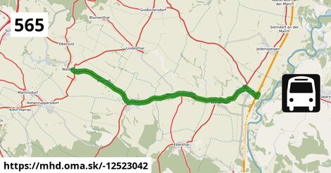
Zastávky na linke
Niedersulz Kirche po ¤, Erdpreß Ort po 2,5 km ¤, Spannberg Geergasse po 4,7 km ¤, Spannberg Hauptplatz po 5,1 km ¤, Spannberg Neugasse po 5,7 km ¤, Velm-Götzendorf Hauptstraße 18/23 po 7,6 km ¤, Velm-Götzendorf Hauptstraße 66/73 po 8,3 km ¤, Velm-Götzendorf Ortsmitte po 9,0 km ¤, Velm-Götzendorf Feldstraße po 9,7 km ¤, Velm-Götzendorf Vorstadt po 9,9 km ¤, Waidendorf Am Alten Friedhof po 11,8 km ¤, Dürnkrut Badsiedlung po 13,7 km ¤, Dürnkrut Schulen po 14,4 km ¤, Dürnkrut Bahnhof po 15 km ¤Zastávky popri linke:
Niedersulz Kirche po ¤, Erdpreß Ort po 2,5 km ¤, Spannberg Geergasse po 4,7 km ¤, Spannberg Geergasse po 4,7 km ¤, Spannberg Hauptplatz po 5,1 km ¤, Spannberg Neugasse po 5,7 km ¤, Spannberg Neugasse po 5,7 km ¤, Velm-Götzendorf Hauptstraße 18/23 po 7,6 km ¤, Velm-Götzendorf Hauptstraße 18/23 po 7,7 km ¤, Velm-Götzendorf Hauptstraße 66/73 po 8,3 km ¤, Velm-Götzendorf Hauptstraße 66/73 po 8,3 km ¤, Velm-Götzendorf Ortsmitte po 9,0 km ¤, Velm-Götzendorf Ortsmitte po 9,0 km ¤, Velm-Götzendorf Feldstraße po 9,7 km ¤, Velm-Götzendorf Feldstraße po 9,7 km ¤, Velm-Götzendorf Vorstadt po 9,9 km ¤, Velm-Götzendorf Vorstadt po 9,9 km ¤, Waidendorf Am Alten Friedhof po 11,8 km ¤, Waidendorf Am Alten Friedhof po 11,8 km ¤, Dürnkrut Badsiedlung po 13,6 km ¤, Dürnkrut Badsiedlung po 13,7 km ¤, Dürnkrut Schulen po 14,4 km ¤, Dürnkrut Schulen po 14,4 km ¤, Dürnkrut Bahnhof po 15 km ¤prestupné linky:
Bus 565: Niedersulz Kirche = > Mistelbach Bahnhof po ¤, Bus 565: Mistelbach Bahnhof = > Niedersulz Kirche po ¤, Bus 534: Niedersulz Kirche = > Blumenthal = > Zistersdorf Schloßplatz po ¤, Bus 505: Zistersdorf Schloßplatz = > Niedersulz Museumsdorf = > Wolkersdorf Bahnhof po 63 m ¤, Bus 505: Zistersdorf Schloßplatz = > Wolkersdorf Bahnhof po 63 m ¤, Bus 505: Wien Floridsdorf = > Niedersulz Museumsdorf = > Zistersdorf Schloßplatz po 63 m ¤, Bus 505: Wien Floridsdorf = > Zistersdorf Schloßplatz po 63 m ¤, Bus 505: Wolkersdorf Bahnhof = > Niedersulz Museumsdorf = > Zistersdorf Schloßplatz po 63 m ¤, Bus 505: Wolkersdorf Bahnhof = > Zistersdorf Schloßplatz po 63 m ¤, Bus 505: Zistersdorf Schloßplatz = > Niedersulz Museumsdorf = > Wien Floridsdorf po 63 m ¤, Bus 505: Zistersdorf Schloßplatz = > Wien Floridsdorf po 63 m ¤, NJ 457: Berlin = > Graz po 15 km ¤, EN 407: Praha - Wien po 15 km ¤, railjet: Praha = > Wien = > Villach po 15 km ¤, REX1: Břeclav = > Wiener Neustadt po 15 km ¤, EuroCity Warszawa – Wien po 15 km ¤, REX1: Wiener Neustadt = > Břeclav po 15 km ¤, EN 40406: Wien - Praha po 15 km ¤, EuroCity Wien – Warszawa po 15 km ¤, railjet: Villach = > Wien = > Praha po 15 km ¤Má spoločné úseky s linkami:
Bus 565: Dürnkrut Bahnhof = > Niedersulz Museumsdorf = > Mistelbach Bahnhof po 63 m ¤ , Bus 565: Dürnkrut Bahnhof = > Niedersulz Kirche po 63 m ¤ , Bus 565: Dürnkrut Bahnhof = > Mistelbach Bahnhof po 63 m ¤ , Bus 505: Zistersdorf Schloßplatz = > Obersulz Ortsmitte = > Niedersulz Museumsdorf = > Wien Floridsdorf po 134 m ¤ , Bus 505: Zistersdorf Schloßplatz = > Obersulz Ortsmitte = > Wien Floridsdorf po 134 m ¤ , Bus 505: Wien Floridsdorf = > Obersulz Ortsmitte = > Zistersdorf Schloßplatz po 134 m ¤ , Bus 534: Matzen Schule = > Zistersdorf Schloßplatz po 134 m ¤ , Bus 534: Matzen Schule = > Obersulz Ortsmitte po 134 m ¤ , Bus 534: Gänserndorf Bahnhof = > Zistersdorf Schloßplatz po 134 m ¤ , Bus 505: Wien Floridsdorf = > Niedersulz Museumsdorf = > Obersulz Ortsmitte = > Zistersdorf Schloßplatz po 134 m ¤ , Bus 505: Zistersdorf Schloßplatz = > Obersulz Ortsmitte = > Niedersulz Museumsdorf = > Wolkersdorf Bahnhof po 134 m ¤ , Bus 565: Mistelbach Bahnhof = > Dürnkrut Bahnhof po 578 m ¤ , Bus 565: Mistelbach Bahnhof = > Niedersulz Museumsdorf = > Dürnkrut Bahnhof po 578 m ¤ , Bus 565: Mistelbach Bahnhof = > Spannberg Hauptplatz po 2,1 km ¤ , Bus 534: Zistersdorf Schloßplatz = > Gänserndorf Bahnhof po 2,1 km ¤ , Bus 536: Reyersdorf Kirche = > Spannberg Hauptplatz po 5,1 km ¤ , Bus 536: Gänserndorf Bahnhof = > Spannberg Hauptplatz po 5,1 km ¤ , Bus 536: Spannberg Hauptplatz = > Reyersdorf Hauptstraße po 5,1 km ¤ , Bus 536: Spannberg Hauptplatz = > Gänserndorf Busbahnhof po 5,1 km ¤ , Bus 565: Mistelbach Bahnhof = > Ebenthal = > Dürnkrut Bahnhof po 12,0 km ¤ , Bus 573: Altlichtenwarth Neusiedler Straße = > Hollabrunn Internat po 13,5 km ¤ , Bus 573: Hollabrunn Internat = > Altlichtenwarth Neusiedler Straße po 13,5 km ¤ , Bus 564: Mistelbach Bahnhof = > Drösing Bahnhof (ohne Mistelbach Hauptplatz, Drösing Kaiser-Josef-Platz) po 14,5 km ¤ , Bus 564: Mistelbach Bahnhof = > Drösing Bahnhof (ohne Großinzersdorf) po 14,5 km ¤ , Bus 564: Dürnkrut Bahnhof = > Wilfersdorf bei Mistelbach Wirtschaftspark = > Mistelbach Hauptplatz = > Mistelbach Bahnhof po 14,5 km ¤ , Bus 564: Dürnkrut Bahnhof = > Wilfersdorf Wirtschaftspark = > Mistelbach Bahnhof po 14,5 km ¤ , Bus 564: Drösing Bahnhof = > Zistersdorf Kaiserstraße (ohne Großinzersdorf) po 14,5 km ¤ , Bus 564: Drösing Bahnhof = > Mistelbach Bahnhof po 14,5 km ¤ , Bus 564: Drösing Bahnhof = > Drösing Kaiser-Josef-Platz = > Wilfersdorf bei Mistelbach Wirtschaftspark = > Mistelbach Bahnhof po 14,5 km ¤ , Bus 564: Drösing Bahnhof = > Drösing Kaiser-Josef-Platz = > Mistelbach Bahnhof po 14,5 km ¤ , Bus 564: Drösing Bahnhof = > Mistelbach Bahnhof (ohne Kettlasbrunn) po 14,5 km ¤ , Bus 537: Ebenthal Florianiplatz = > Dürnkrut Bahnhof po 14,5 km ¤ , Bus 537: Gänserndorf Bahnhof = > Dürnkrut Bahnhof po 14,5 km ¤ , Bus 537: Matzen Schule = > Dürnkrut Bahnhof po 14,5 km ¤ , Bus 565: Dürnkrut Bahnhof = > Spannberg Hauptplatz po 14,5 km ¤ , Bus 537: Dürnkrut Bahnhof = > Ebenthal Florianiplatz po 14,5 km ¤ , Bus 537: Dürnkrut Bahnhof = > Matzen Schule = > Gänserndorf Bahnhof po 14,5 km ¤ , Bus 537: Dürnkrut Bahnhof = > Gänserndorf Bahnhof po 14,5 km ¤ , Bus 537: Dürnkrut Bahnhof = > Prottes Volksschule po 14,5 km ¤ , Bus 536: Matzen Schule = > Dürnkrut Bahnhof po 14,5 km ¤ , Bus 536: Dürnkrut Bahnhof = > Gänserndorf Busbahnhof po 14,5 km ¤ , Bus 536: Gänserndorf Bahnhof = > Dürnkrut Bahnhof po 14,5 km ¤ , Bus 564: Zistersdorf Schloßplatz = > Drösing Bahnhof (ohne Drösing Kaiser-Josef-Platz) po 14,5 km ¤ , Bus 564: Mistelbach Hauptplatz = > Mistelbach Alleegasse = > Drösing Bahnhof po 14,5 km ¤ , Bus 564: Mistelbach Bahnhof = > Dürnkrut Bahnhof (ohne Mistelbach Hauptplatz) po 14,5 km ¤ , Bus 564: Mistelbach Bahnhof = > Dürnkrut Bahnhof po 14,5 km ¤ , Bus 564: Mistelbach Bahnhof = > Drösing Bahnhof po 14,5 km ¤ , Bus 564: Mistelbach Bahnhof = > Mistelbach Wirtschaftspark = > Drösing Bahnhof po 14,5 km ¤Trasa vedie cez obce
Gemeinde Dürnkrut: 4,7 km (30.6 %), Gemeinde Sulz im Weinviertel: 4,2 km (27.3 %), Gemeinde Velm-Götzendorf: 3,7 km (24.1 %), Gemeinde Spannberg: 2,8 km (17.9 %),

Podobné linky 565:
ine: Bus 565: Stará Břeclav, Křiž. Ladná = > Autobusové nádraží, , ine: Bus 565: Stará Břeclav, Křiž. Ladná = > Městský hřbitov, , ine: Bus 565: Stará Břeclav, Křiž. Ladná = > Gumotex = > Městský hřbitov, , ine: Bus 565: Městský hřbitov = > Stará Břeclav, Křiž. Ladná, , ine: Bus 565: Autobusové nádraží = > Stará Břeclav, Křiž. Ladná, , ine: Bus 565: Cífer = > Pezinok, , ine: Bus 565: Mistelbach Bahnhof = > Niedersulz Kirche, , ine: Bus 565: Dürnkrut Bahnhof = > Spannberg Hauptplatz, , ine: Bus 565 Pezinok = > Cífer, , ine: Bus 565: Dürnkrut Bahnhof = > Mistelbach Bahnhof, , ine: Bus 565: Dürnkrut Bahnhof = > Niedersulz Museumsdorf = > Mistelbach Bahnhof, , ine: Bus 565: Mistelbach Bahnhof = > Spannberg Hauptplatz, , ine: Bus 565: Mistelbach Bahnhof = > Ebenthal = > Dürnkrut Bahnhof, , ine: Bus 565: Niedersulz Kirche = > Mistelbach Bahnhof, , ine: Bus 565: Mistelbach Bahnhof = > Niedersulz Museumsdorf = > Dürnkrut Bahnhof, , ine: Bus 565: Dürnkrut Bahnhof = > Niedersulz Kirche, , ine: Bus 565: Mistelbach Bahnhof = > Dürnkrut Bahnhof,Viac info: aktualizovať mapu, uprav v JOSM (pokročilé), -12523042, stiahni GPX, route: bus, to: Dürnkrut Bahnhof, from: Niedersulz Kirche, network: VOR, route name: Bus 565: Niedersulz Kirche => Dürnkrut Bahnhof, osm version: 7, osm changeset: 0, osm timestamp: 2025 10 30T05:56:52Z, Q2516485, 2, dlzka: 15366, pocet seg: 1, lon: 16.7717, lat: 48.4709, povodna farba: gschwindl,