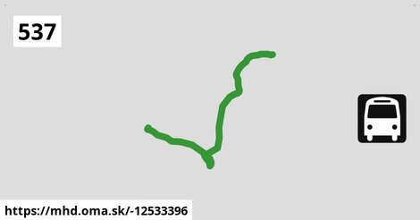
Zastávky na linke
Matzen Schule po ¤, Matzen Hofgartenstraße po 454 m ¤, Prottes Lerchengasse po 3,8 km ¤, Prottes Dörfleser Straße po 5,0 km ¤, Prottes Friedensgasse po 5,2 km ¤, Prottes Volksschule po 5,6 km ¤, Ebenthal Florianiplatz po 13,0 km ¤, Ebenthal Stillfrieder Straße po 13,5 km ¤Zastávky popri linke:
Matzen Schule po ¤, Matzen Hofgartenstraße po 454 m ¤, Matzen Hofgartenstraße po 465 m ¤, Prottes Lerchengasse po 3,8 km ¤, Prottes Lerchengasse po 3,8 km ¤, Prottes Dörfleser Straße po 5,0 km ¤, Prottes Friedensgasse po 5,1 km ¤, Prottes Friedensgasse po 5,2 km ¤, Prottes Volksschule po 5,6 km ¤, Prottes Volksschule po 5,6 km ¤, Ebenthal Florianiplatz po 13,0 km ¤, Ebenthal Stillfrieder Straße po 13,5 km ¤prestupné linky:
Bus 532: Strasshof Lehárgasse = > Matzen Schule po ¤, Bus 532: Matzen Schule = > Strasshof Lehargasse po 20 m ¤, Bus 536: Spannberg Hauptplatz = > Reyersdorf Hauptstraße po 20 m ¤, Bus 536: Dürnkrut Bahnhof = > Gänserndorf Busbahnhof po 25 m ¤, Bus 536: Spannberg Hauptplatz = > Gänserndorf Busbahnhof po 25 m ¤, Bus 534: Hohenruppersdorf Gemeindeamt = > Gänserndorf Siebenbrunner Straße po 25 m ¤, Bus 534: Raggendorf Hauptstraße = > Matzen Schule po 34 m ¤Má spoločné úseky s linkami:
Bus 534: Matzen Schule = > Hohenruppersdorf Marktplatz po 34 m ¤ , Bus 536: Gänserndorf Bahnhof = > Spannberg Hauptplatz po 34 m ¤ , Bus 534: Matzen Schule = > Zistersdorf Schloßplatz po 34 m ¤ , Bus 536: Matzen Schule = > Dürnkrut Bahnhof po 34 m ¤ , Bus 536: Reyersdorf Kirche = > Spannberg Hauptplatz po 34 m ¤ , Bus 532: Matzen Schule = > Auersthal Schulen = > Strasshof Lehargasse po 34 m ¤ , Bus 536: Gänserndorf Bahnhof = > Dürnkrut Bahnhof po 34 m ¤ , Bus 534: Matzen Schule = > Obersulz Ortsmitte po 34 m ¤ , Bus 534: Zistersdorf Schloßplatz = > Gänserndorf Bahnhof po 5,6 km ¤ , Bus 534: Gänserndorf Bahnhof = > Zistersdorf Schloßplatz po 5,6 km ¤ , Bus 537: Ebenthal Stillfrieder Straße = > Gänserndorf Bahnhof po 5,6 km ¤ , Bus 537: Ebenthal Stillfrieder Straße = > OMV = > Gänserndorf Bahnhof po 5,6 km ¤ , Bus 537: Dürnkrut Bahnhof = > Gänserndorf Bahnhof po 5,6 km ¤ , Bus 537: Gänserndorf Bahnhof = > Matzen Schule po 5,6 km ¤ , Bus 530: Gänserndorf Bahnhof = > Auersthal Europa-Siedlung = > Wolkersdorf Wiener Straße po 5,6 km ¤ , Bus 530: Gänserndorf Bahnhof = > Wolkersdorf Wiener Straße po 5,6 km ¤ , Bus 530: Wolkersdorf Bahnhof = > Gänserndorf Bahnhof po 5,6 km ¤ , Bus 530: Gänserndorf Bahnhof = > Auersthal Europa-Siedlung = > Wolkersdorf Wiener Straße po 5,6 km ¤ , Bus 530: Gänserndorf Bahnhof = > Wolkersdorf Wiener Straße po 5,6 km ¤ , Bus 530: Wolkersdorf Wiener Straße = > Gänserndorf Bahnhof po 5,6 km ¤ , Bus 530: Raggendorf Busbahnhof = > Gänserndorf Bahnhof po 5,6 km ¤ , Bus 537: Dürnkrut Bahnhof = > Prottes Volksschule po 12,5 km ¤ , Bus 537: Ebenthal Stillfrieder Straße = > Prottes Volksschule po 12,5 km ¤ , Bus 537: Gänserndorf Bahnhof = > Ebenthal Stillfrieder Straße (ohne Matzen) po 12,5 km ¤ , Bus 537: Gänserndorf Bahnhof = > OMV = > Ebenthal Stillfrieder Straße po 12,5 km ¤ , Bus 537: Gänserndorf Bahnhof = > Dürnkrut Bahnhof po 12,5 km ¤ , Bus 565: Mistelbach Bahnhof = > Ebenthal = > Dürnkrut Bahnhof po 12,5 km ¤ , Bus 537: Prottes Volksschule = > Ebenthal Stillfrieder Straße (ohne Matzen) po 12,5 km ¤ , Bus 537: Matzen Schule = > Dürnkrut Bahnhof po 12,5 km ¤ , Bus 537: Dürnkrut Bahnhof = > Matzen Schule = > Gänserndorf Bahnhof po 12,5 km ¤ , Bus 537: Gänserndorf Bahnhof = > Ebenthal Stillfrieder Straße po 12,5 km ¤ , Bus 526: Gänserndorf Hans-Kudlich-Gasse = > Ebenthal Stillfrieder Straße po 13,0 km ¤ , Bus 537: Ebenthal Florianiplatz = > Dürnkrut Bahnhof po 13,0 km ¤ , Bus 537: Dürnkrut Bahnhof = > Ebenthal Florianiplatz po 13,0 km ¤Trasa vedie cez obce
Gemeinde Prottes: 6,7 km (49.4 %), Ebenthal: 4,5 km (33.5 %), Gemeinde Matzen-Raggendorf: 2,3 km (16.8 %),
Podobné linky 537:
ine: Bus 537: Dürnkrut Bahnhof = > Matzen Schule = > Gänserndorf Bahnhof, , ine: Bus 537: Ebenthal Stillfrieder Straße = > Gänserndorf Bahnhof, , ine: Bus 537: Gänserndorf Bahnhof = > Ebenthal Stillfrieder Straße, , ine: Bus 537: Prottes Volksschule = > Ebenthal Stillfrieder Straße (ohne Matzen), , ine: Bus 537: Dürnkrut Bahnhof = > Prottes Volksschule, , ine: Bus 537: Ebenthal Stillfrieder Straße = > Prottes Volksschule, , ine: Bus 537: Ebenthal Florianiplatz = > Dürnkrut Bahnhof, , ine: Bus 537: Dürnkrut Bahnhof = > Gänserndorf Bahnhof, , ine: Bus 537: Dürnkrut Bahnhof = > Ebenthal Florianiplatz, , ine: Bus 537: Gänserndorf Bahnhof = > Matzen Schule, , ine: Bus 537: Gänserndorf Bahnhof = > Ebenthal Stillfrieder Straße (ohne Matzen), , ine: Bus 537: Ebenthal Stillfrieder Straße = > OMV = > Gänserndorf Bahnhof, , ine: Bus 537: Gänserndorf Bahnhof = > OMV = > Ebenthal Stillfrieder Straße, , ine: Bus 537: Gänserndorf Bahnhof = > Dürnkrut Bahnhof, , ine: Bus 537: Matzen Schule = > Dürnkrut Bahnhof,Viac info: aktualizovať mapu, uprav v JOSM (pokročilé), -12533396, stiahni GPX, route: bus, to: Ebenthal Stillfrieder Straße, from: Matzen Schule, network: VOR, route name: Bus 537: Matzen Schule => Ebenthal Stillfrieder Straße, osm version: 11, osm changeset: 0, osm timestamp: 2024 04 09T16:52:31Z, Q2516485, de:Verkehrsverbund Ost Region, 2, dlzka: 13476, pocet seg: 1, lon: 16.7453, lat: 48.4058, povodna farba: dr. richard,