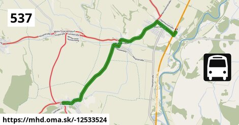
Zastávky na linke
Dürnkrut Bahnhof po ¤, Dürnkrut Schulen po 0,99 km ¤, Dürnkrut Badsiedlung po 1,80 km ¤, Waidendorf Feuerwehr po 3,8 km ¤, Ebenthal Stillfrieder Straße po 7,8 km ¤, Ebenthal Florianiplatz po 8,3 km ¤Zastávky popri linke:
Dürnkrut Bahnhof po ¤, Dürnkrut Schulen po 0,99 km ¤, Dürnkrut Schulen po 1,00 km ¤, Dürnkrut Badsiedlung po 1,77 km ¤, Dürnkrut Badsiedlung po 1,80 km ¤, Waidendorf Feuerwehr po 3,8 km ¤, Waidendorf Feuerwehr po 3,8 km ¤, Ebenthal Stillfrieder Straße po 7,8 km ¤, Ebenthal Florianiplatz po 8,3 km ¤prestupné linky:
REX1: Wiener Neustadt = > Břeclav po 201 m ¤, EuroCity Wien – Warszawa po 201 m ¤, EN 40406: Wien - Praha po 201 m ¤, railjet: Villach = > Wien = > Praha po 201 m ¤, EuroCity Warszawa – Wien po 206 m ¤, REX1: Břeclav = > Wiener Neustadt po 206 m ¤, EN 407: Praha - Wien po 206 m ¤, railjet: Praha = > Wien = > Villach po 206 m ¤, NJ 457: Berlin = > Graz po 206 m ¤Má spoločné úseky s linkami:
Bus 565: Mistelbach Bahnhof = > Dürnkrut Bahnhof po 0,90 km ¤ , Bus 564: Mistelbach Bahnhof = > Drösing Bahnhof (ohne Mistelbach Hauptplatz, Drösing Kaiser-Josef-Platz) po 0,90 km ¤ , Bus 564: Mistelbach Bahnhof = > Drösing Bahnhof (ohne Großinzersdorf) po 0,90 km ¤ , Bus 564: Dürnkrut Bahnhof = > Wilfersdorf bei Mistelbach Wirtschaftspark = > Mistelbach Hauptplatz = > Mistelbach Bahnhof po 0,90 km ¤ , Bus 564: Dürnkrut Bahnhof = > Wilfersdorf Wirtschaftspark = > Mistelbach Bahnhof po 0,90 km ¤ , Bus 564: Drösing Bahnhof = > Zistersdorf Kaiserstraße (ohne Großinzersdorf) po 0,90 km ¤ , Bus 564: Drösing Bahnhof = > Mistelbach Bahnhof po 0,90 km ¤ , Bus 564: Drösing Bahnhof = > Drösing Kaiser-Josef-Platz = > Wilfersdorf bei Mistelbach Wirtschaftspark = > Mistelbach Bahnhof po 0,90 km ¤ , Bus 564: Drösing Bahnhof = > Drösing Kaiser-Josef-Platz = > Mistelbach Bahnhof po 0,90 km ¤ , Bus 564: Drösing Bahnhof = > Mistelbach Bahnhof (ohne Kettlasbrunn) po 0,90 km ¤ , Bus 565: Niedersulz Kirche = > Dürnkrut Bahnhof po 0,90 km ¤ , Bus 565: Mistelbach Bahnhof = > Niedersulz Museumsdorf = > Dürnkrut Bahnhof po 0,90 km ¤ , Bus 565: Dürnkrut Bahnhof = > Spannberg Hauptplatz po 0,90 km ¤ , Bus 565: Dürnkrut Bahnhof = > Niedersulz Kirche po 0,90 km ¤ , Bus 565: Dürnkrut Bahnhof = > Mistelbach Bahnhof po 0,90 km ¤ , Bus 565: Dürnkrut Bahnhof = > Niedersulz Museumsdorf = > Mistelbach Bahnhof po 0,90 km ¤ , Bus 536: Matzen Schule = > Dürnkrut Bahnhof po 0,90 km ¤ , Bus 536: Gänserndorf Bahnhof = > Dürnkrut Bahnhof po 0,90 km ¤ , Bus 536: Dürnkrut Bahnhof = > Gänserndorf Busbahnhof po 0,90 km ¤ , Bus 564: Zistersdorf Schloßplatz = > Drösing Bahnhof (ohne Drösing Kaiser-Josef-Platz) po 0,90 km ¤ , Bus 564: Mistelbach Hauptplatz = > Mistelbach Alleegasse = > Drösing Bahnhof po 0,90 km ¤ , Bus 564: Mistelbach Bahnhof = > Dürnkrut Bahnhof po 0,90 km ¤ , Bus 564: Mistelbach Bahnhof = > Dürnkrut Bahnhof (ohne Mistelbach Hauptplatz) po 0,90 km ¤ , Bus 564: Mistelbach Bahnhof = > Drösing Bahnhof po 0,90 km ¤ , Bus 564: Mistelbach Bahnhof = > Mistelbach Wirtschaftspark = > Drösing Bahnhof po 0,90 km ¤ , Bus 573: Altlichtenwarth Neusiedler Straße = > Hollabrunn Internat po 1,92 km ¤ , Bus 573: Hollabrunn Internat = > Altlichtenwarth Neusiedler Straße po 1,92 km ¤ , Bus 537: Ebenthal Florianiplatz = > Dürnkrut Bahnhof po 3,8 km ¤ , Bus 565: Mistelbach Bahnhof = > Ebenthal = > Dürnkrut Bahnhof po 3,8 km ¤ , Bus 537: Matzen Schule = > Dürnkrut Bahnhof po 3,8 km ¤ , Bus 537: Gänserndorf Bahnhof = > Dürnkrut Bahnhof po 3,8 km ¤ , Bus 537: Dürnkrut Bahnhof = > Matzen Schule = > Gänserndorf Bahnhof po 7,7 km ¤ , Bus 537: Dürnkrut Bahnhof = > Prottes Volksschule po 7,7 km ¤ , Bus 537: Dürnkrut Bahnhof = > Gänserndorf Bahnhof po 7,7 km ¤ , Bus 537: Gänserndorf Bahnhof = > Ebenthal Stillfrieder Straße (ohne Matzen) po 8,2 km ¤ , Bus 537: Ebenthal Stillfrieder Straße = > OMV = > Gänserndorf Bahnhof po 8,2 km ¤ , Bus 537: Prottes Volksschule = > Ebenthal Stillfrieder Straße (ohne Matzen) po 8,2 km ¤ , Bus 537: Matzen Schule = > Ebenthal Stillfrieder Straße po 8,2 km ¤ , Bus 537: Gänserndorf Bahnhof = > Ebenthal Stillfrieder Straße po 8,2 km ¤ , Bus 537: Ebenthal Stillfrieder Straße = > Gänserndorf Bahnhof po 8,2 km ¤ , Bus 537: Gänserndorf Bahnhof = > OMV = > Ebenthal Stillfrieder Straße po 8,2 km ¤ , Bus 526: Gänserndorf Hans-Kudlich-Gasse = > Ebenthal Stillfrieder Straße po 8,2 km ¤ , Bus 537: Ebenthal Stillfrieder Straße = > Prottes Volksschule po 8,2 km ¤

Podobné linky 537:
ine: Bus 537: Dürnkrut Bahnhof = > Prottes Volksschule, , ine: Bus 537: Gänserndorf Bahnhof = > Ebenthal Stillfrieder Straße, , ine: Bus 537: Gänserndorf Bahnhof = > Matzen Schule, , ine: Bus 537: Ebenthal Stillfrieder Straße = > Gänserndorf Bahnhof, , ine: Bus 537: Matzen Schule = > Ebenthal Stillfrieder Straße, , ine: Bus 537: Ebenthal Florianiplatz = > Dürnkrut Bahnhof, , ine: Bus 537: Dürnkrut Bahnhof = > Matzen Schule = > Gänserndorf Bahnhof, , ine: Bus 537: Ebenthal Stillfrieder Straße = > Prottes Volksschule, , ine: Bus 537: Gänserndorf Bahnhof = > Ebenthal Stillfrieder Straße (ohne Matzen), , ine: Bus 537: Dürnkrut Bahnhof = > Gänserndorf Bahnhof, , ine: Bus 537: Prottes Volksschule = > Ebenthal Stillfrieder Straße (ohne Matzen), , ine: Bus 537: Ebenthal Stillfrieder Straße = > OMV = > Gänserndorf Bahnhof, , ine: Bus 537: Gänserndorf Bahnhof = > OMV = > Ebenthal Stillfrieder Straße, , ine: Bus 537: Gänserndorf Bahnhof = > Dürnkrut Bahnhof, , ine: Bus 537: Matzen Schule = > Dürnkrut Bahnhof,Viac info: aktualizovať mapu, uprav v JOSM (pokročilé), -12533524, stiahni GPX, route: bus, to: Ebenthal Florianiplatz, from: Dürnkrut Bahnhof, network: VOR, route name: Bus 537: Dürnkrut Bahnhof => Ebenthal Florianiplatz, osm version: 7, osm changeset: 0, osm timestamp: 2026 01 06T19:40:01Z, Q2516485, 2, dlzka: 8272, pocet seg: 1, lon: 16.8222, lat: 48.4584, povodna farba: dr. richard,