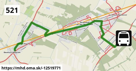
Zastávky na linke
Deutsch-Wagram Gemeindeamt po ¤,
Deutsch-Wagram Bahnhof po 643 m ¤,
Deutsch-Wagram Eichengasse po 1,26 km ¤,
Helmahof Stefan Fadinger-Straße po 1,55 km ¤,
Helmahof Albrecht-Dürer-Gasse po 1,78 km ¤,
Helmahof Andreas-Reischek-Gasse po 2,1 km ¤,
Helmahof Gottlieb-Fichte-Gasse po 2,4 km ¤,
Helmahof Lindenhof po 3,1 km ¤,
Helmahof Kleistgasse po 3,4 km ¤,
Helmahof Quadenstraße po 3,8 km ¤,
Helmahof Ofnerstraße po 4,1 km ¤,
Helmahof Bahnhof po 4,7 km ¤,
Strasshof Lehárgasse po 7,0 km ¤,
Strasshof Rote Burg po 8,1 km ¤,
Strasshof Billrothgasse po 8,6 km ¤,
Strasshof Petzoldgasse po 9,2 km ¤,
Strasshof Anzengrubergasse po 9,6 km ¤,
Strasshof Kleistgasse po 10,7 km ¤,
Strasshof Promenadestraße po 11,2 km ¤,
Strasshof Grenzstraße 3 po 12,0 km ¤,
Gänserndorf Süd Forstgasse po 12,3 km ¤,
Gänserndorf Süd Blumengasse po 12,8 km ¤,
Gänserndorf Süd Äußere-Jochen-Straße po 13,1 km ¤,
Gänserndorf Süd Volksschule po 14,3 km ¤Zastávky popri linke:, 1 z 2
Deutsch-Wagram Gemeindeamt po ¤,
Deutsch-Wagram Gemeindeamt po 64 m ¤,
Deutsch-Wagram Bahnhof po 643 m ¤,
Deutsch-Wagram Bahnhof po 651 m ¤,
Deutsch-Wagram Eichengasse po 1,26 km ¤,
Deutsch-Wagram Eichengasse po 1,26 km ¤,
Helmahof Stefan Fadinger-Straße po 1,53 km ¤,
Helmahof Stefan Fadinger-Straße po 1,55 km ¤,
Helmahof Albrecht-Dürer-Gasse po 1,78 km ¤,
Helmahof Albrecht-Dürer-Gasse po 1,80 km ¤,
Helmahof Andreas-Reischek-Gasse po 2,1 km ¤,
Helmahof Andreas-Reischek-Gasse po 2,1 km ¤,
Helmahof Gottlieb-Fichte-Gasse po 2,4 km ¤,
Helmahof Gottlieb-Fichte-Gasse po 2,4 km ¤,
Helmahof Lindenhof po 3,1 km ¤,
Helmahof Lindenhof po 3,1 km ¤,
Helmahof Kleistgasse po 3,4 km ¤,
Helmahof Kleistgasse po 3,5 km ¤,
Helmahof Quadenstraße po 3,8 km ¤,
Helmahof Quadenstraße po 3,8 km ¤,
Helmahof Ofnerstraße po 4,1 km ¤,
Helmahof Ofnerstraße po 4,1 km ¤,
Helmahof Bahnhof po 4,7 km ¤,
Helmahof Bahnhof po 4,7 km ¤Zastávky popri linke:, 2 z 2
Strasshof Industriestraße po 6,0 km ¤,
Strasshof Lehárgasse po 6,9 km ¤,
Strasshof Lehárgasse po 7,0 km ¤,
Strasshof Rote Burg po 8,1 km ¤,
Strasshof Rote Burg po 8,1 km ¤,
Strasshof Billrothgasse po 8,5 km ¤,
Strasshof Billrothgasse po 8,6 km ¤,
Strasshof Petzoldgasse po 9,2 km ¤,
Strasshof Petzoldgasse po 9,2 km ¤,
Strasshof Anzengrubergasse po 9,6 km ¤,
Strasshof Anzengrubergasse po 9,7 km ¤,
Strasshof Kleistgasse po 10,7 km ¤,
Strasshof Kleistgasse po 10,7 km ¤,
Strasshof Promenadestraße po 11,2 km ¤,
Strasshof Promenadestraße po 11,2 km ¤,
Strasshof Grenzstraße 3 po 11,9 km ¤,
Strasshof Grenzstraße 3 po 12,0 km ¤,
Gänserndorf Süd Forstgasse po 12,3 km ¤,
Gänserndorf Süd Forstgasse po 12,4 km ¤,
Gänserndorf Süd Blumengasse po 12,8 km ¤,
Gänserndorf Süd Blumengasse po 12,8 km ¤,
Gänserndorf Süd Äußere-Jochen-Straße po 13,1 km ¤,
Gänserndorf Süd Volksschule po 14,3 km ¤Má spoločné úseky s linkami:
Bus 554: Leopoldsdorf im Marchfeld Rathausplatz = > Deutsch-Wagram Bahnhof po 577 m ¤ ,
Bus 522: Aderklaa Dorfanger = > Deutsch-Wagram Bahnhof po 577 m ¤ ,
Bus 554: Deutsch-Wagram Bahnhof = > Orth an der Donau Schlossplatz po 577 m ¤ ,
Bus 554: Orth an der Donau Gemeindeamt = > Deutsch-Wagram Bahnhof po 577 m ¤ ,
Bus 554: Orth an der Donau Schlossplatz = > Deutsch-Wagram Bahnhof po 577 m ¤ ,
Bus 521: Helmahof Gottlieb-Fichte-Gasse = > Deutsch-Wagram po 0,94 km ¤ ,
Bus 520: Bad Pirawarth Kurzentrum = > Wien Aderklaaer Straße po 1,06 km ¤ ,
Bus 520: Kollnbrunn Brünner Straße = > Wien Aderklaaer Straße po 1,06 km ¤ ,
Bus 520: Raggendorf Busbahnhof = > Wien Aderklaaer Straße po 1,06 km ¤ ,
Bus 520: Wien Aderklaaer Straße = > Raggendorf Busbahnhof po 1,06 km ¤ ,
Bus 520: Deutsch-Wagram Gemeindeamt = > Auersthal Schulen po 1,06 km ¤ ,
Bus 521: Deutsch-Wagram = > Helmahof Bahnhof po 1,06 km ¤ ,
Bus 520: Wien Aderklaaer Straße = > Bad Pirawarth Kurzentrum po 1,06 km ¤ ,
Bus 520: Wien Aderklaaer Straße = > Kollnbrunn Brünner Straße po 1,06 km ¤ ,
Bus 521: Helmahof Bahnhof = > Deutsch-Wagram (nicht über Helmahof Gottlieb-Fichte-Gasse) po 1,06 km ¤ ,
Bus 521: Helmahof Bahnhof = > Deutsch-Wagram po 1,06 km ¤ ,
Bus 522: Aderklaa Dorfanger = > Helmahof Bahnhof po 4,7 km ¤ ,
Bus 523: Schulcampus = > Anzengrubergasse po 5,9 km ¤ ,
Bus 521: Gänserndorf = > Deutsch-Wagram po 6,9 km ¤ ,
Bus 521: Deutsch-Wagram = > Gänserndorf po 6,9 km ¤ ,
Bus 521: Deutsch-Wagram = > Gänserndorf Bahnhof po 6,9 km ¤ ,
Bus 521: Gänserndorf = > Deutsch-Wagram (nicht über Helmahof Andreas-Reischek-Gasse) po 6,9 km ¤ ,
Bus 523: Industriestraße = > Schulcampus po 8,2 km ¤ ,
Bus 532: Strasshof Lehárgasse = > Matzen Schule po 8,2 km ¤ ,
Bus 521: Deutsch-Wagram = > Gänserndorf Bahnhof po 8,2 km ¤ ,
Bus 532: Matzen Schule = > Auersthal Schulen = > Strasshof Lehargasse po 8,4 km ¤ ,
Bus 523: Anton-Fromm-Gasse = > Schulcampus po 8,4 km ¤ ,
Bus 532: Schönkirchen Volksschule = > Reyersdorf Hauptstraße = > Strasshof Lehargasse po 8,4 km ¤ ,
Bus 524: Strasshof Industriestraße = > Gänserndorf Busbahnhof po 8,4 km ¤ ,
Bus 532: Matzen Schule = > Strasshof Lehargasse po 8,4 km ¤ ,
Bus 523: Albert-Sever-Straße = > Schulcampus po 10,0 km ¤ ,
Bus 523: Schulcampus = > Silberwald po 10,0 km ¤ ,
Bus 523: Werndlgasse = > Schulcampus po 10,0 km ¤ ,
Bus 524: Strasshof Kleistgasse = > Gänserndorf Bahnhof po 10,7 km ¤ ,
Bus 523: Sillerstraße = > Schulcampus po 10,7 km ¤ ,
Bus 524: Gänserndorf Hans-Kudlich-Gasse = > Strasshof Werndlgasse po 14,3 km ¤ ,
Bus 524: Strasshof Werndlgasse = > Gänserndorf Busbahnhof po 14,3 km ¤ ,
Bus 551: Groß-Enzersdorf Auvorstadt = > Gänserndorf Busbahnhof po 14,3 km ¤ ,
Bus 524: Strasshof Grenzstraße 3 = > Gänserndorf Bahnhof po 14,3 km ¤ ,
Bus 551: Groß Enzersdorf Volksschule = > Gänserndorf Busbahnhof po 14,3 km ¤ ,
Bus 524: Gänserndorf Süd Volksschule = > Strasshof Werndlgasse = > Gänserndorf Süd Habichtweg po 14,3 km ¤ ,
Bus 524: Gänserndorf Bahnhof = > Strasshof Werndlgasse = > Gänserndorf Süd Habichtweg po 14,3 km ¤ ,
Bus 524: Gänserndorf Volksschule = > Strasshof Werndlgasse po 14,3 km ¤ ,
Bus 524: Gänserndorf Volksschule = > Gänserndorf Süd Eschenweg = > Strasshof Werndlgasse po 14,3 km ¤ ,
Bus 551: Gänserndorf = > Groß-Enzersdorf po 14,3 km ¤ Podobné linky 521:
ine: Bus 521: Gänserndorf = > Deutsch-Wagram, ,
ine: Bus 521: Helmahof Bahnhof = > Deutsch-Wagram (nicht über Helmahof Gottlieb-Fichte-Gasse), ,
ine: 521, ,
ine: Bus 521: Helmahof Bahnhof = > Deutsch-Wagram, ,
ine: Bus 521: Helmahof Gottlieb-Fichte-Gasse = > Deutsch-Wagram, ,
ine: Bus 521: Deutsch-Wagram = > Gänserndorf, ,
ine: Bus 521: Pezinok = > Limbach, ,
ine: Bus 521: Limbach = > Pezinok, ,
ine: Bus 521: Deutsch-Wagram = > Gänserndorf Bahnhof, ,
ine: Bus 521: Deutsch-Wagram = > Gänserndorf Bahnhof, ,
ine: Bus 521: Deutsch-Wagram = > Helmahof Bahnhof, ,
ine: Bus 521, ,
ine: Bus 521: Gänserndorf = > Deutsch-Wagram (nicht über Helmahof Andreas-Reischek-Gasse),
Viac info:
aktualizovať mapu,
uprav v JOSM (pokročilé),
-12519771,
stiahni GPX, route: bus, to: Gänserndorf Süd Volksschule, from: Deutsch Wagram Gemeindeamt, network: VOR, route name: Bus 521: Deutsch Wagram => Gänserndorf Süd Volksschule, osm version: 22, osm changeset: 0, osm timestamp: 2026 01 12T03:35:49Z, Q2516485, 2, dlzka: 14274, pocet seg: 1, lon: 16.6228, lat: 48.3120, povodna farba: dr. richard no,
Zdroj dát
Mapové údaje pochádzajú z
www.OpenStreetMap.org, databáza je prístupná pod licenciou
ODbL.

Mapový podklad vytvára a aktualizuje
Freemap Slovakia (www.freemap.sk), šíriteľný pod licenciou CC-BY-SA. Fotky sme čerpali z galérie portálu freemap.sk, autori fotiek sú uvedení pri jednotlivých fotkách a sú šíriteľné pod licenciou CC a z wikipédie. Výškový profil trás čerpáme z
SRTM. Niečo vám chýba?
Pridajte to. Sme radi, že tvoríte slobodnú wiki mapu sveta.