Zastávky na linke
Stopfenreuth Kirche po ¤, Engelhartstetten Gemeindeamt po 6,3 km ¤, Groißenbrunn Schloßhofer Straße po 11,2 km ¤, Schloßhof Prinz-Eugen-Straße po 13,9 km ¤, Markthof Kirche po 18 km ¤, Markthof Nr. 10 po 19 km ¤Zastávky popri linke:
Stopfenreuth Kirche po ¤, Engelhartstetten Gemeindeamt po 6,2 km ¤, Engelhartstetten Gemeindeamt po 6,3 km ¤, Engelhartstetten Volksschule po 6,4 km ¤, Engelhartstetten Volksschule po 6,5 km ¤, Engelhartstetten Kirche po 6,7 km ¤, Groißenbrunn Schloßhofer Straße po 11,2 km ¤, Schloßhof Prinz-Eugen-Straße po 13,9 km ¤, Markthof Kirche po 18 km ¤, Markthof Kirche po 18 km ¤, Markthof Nr. 10 po 19 km ¤, Markthof Nr. 10 po 19 km ¤prestupné linky:
Bus 552: Groß-Enzersdorf Stadtmauer = > Stopfenreuth Uferstraße po 315 m ¤, Bus 552: Groß-Enzersdorf Busbahnhof = > Stopfenreuth Uferstraße po 315 m ¤Má spoločné úseky s linkami:
Bus 546: Obersiebenbrunn Marktplatz = > Stopfenreuth po 302 m ¤ , Bus 546: Stopfenreuth = > Gänserndorf po 302 m ¤ , Bus 546: Gänserndorf = > Stopfenreuth po 302 m ¤ , Bus 552: Stopfenreuth Uferstraße = > Großenzersdorf Busbahnhof po 315 m ¤ , Bus 552: Stopfenreuth Uferstraße = > Großenzersdorf Stadtmauer po 315 m ¤ , Bus 552: Stopfenreuth Uferstraße = > Orth an der Donau Biotech Campus = > Groß-Enzersdorf Busbahnhof po 315 m ¤ , Bus 552: Stopfenreuth Uferstraße = > Wien Aspernstraße po 315 m ¤ , Bus 546: Stopfenreuth = > Engelhartstetten Volksschule po 5,6 km ¤ , Bus 550: Wien Aspernstraße = > Hainburg an der Donau Landesklinikum po 5,6 km ¤ , Bus 550: Orth an der Donau Schlossplatz = > Engelhartstetten Volksschule po 5,6 km ¤ , Bus 550: Engelhartstetten Kirche = > Wien Aspernstraße po 5,8 km ¤ , Bus 546: Engelhartstetten Volksschule = > Stopfenreuth po 5,8 km ¤ , Bus 550: Hainburg an der Donau Landesklinikum = > Wien Aspernstraße po 5,8 km ¤ , Bus 550: Engelhartstetten Volksschule = > Großenzersdorf Stadtmauer po 5,8 km ¤ , Bus 546: Schönfeld im Marchfeld Hauptstraße = > Engelhartstetten Volksschule po 9,9 km ¤ , Bus 546: Markthof = > Stopfenreuth po 9,9 km ¤ , Bus 546: Stopfenreuth = > Loimersdorf Kirche = > Markthof po 10,9 km ¤ , Bus 540: Wien Hausfeldstraße = > Schloßhof po 10,9 km ¤ , Bus 540: Schloßhof = > Wien Aspern Nord po 10,9 km ¤ , Bus 540: Schloßhof = > Obersiebenbrunn Marktplatz po 10,9 km ¤ , Bus 546: Gänserndorf = > Markthof = > Stopfenreuth po 18 km ¤ , Bus 528: Gänserndorf Hans-Kudlich-Gasse = > Markthof Nr. 10 po 19 km ¤ , Bus 528: Markthof Nr. 10 = > Gänserndorf Busbahnhof po 19 km ¤Trasa vedie cez obce
Engelhartstetten: 19 km (100 %),


Podobné linky 546:
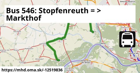
ine: Bus 546: Schönfeld im Marchfeld Hauptstraße = > Engelhartstetten Volksschule, , ine: Bus 546: Lassee = > Schönfeld, , ine: Bus 546: Stopfenreuth = > Gänserndorf, , ine: Bus 546: Markthof = > Stopfenreuth, , ine: Bus 546: Stopfenreuth = > Engelhartstetten Volksschule, , ine: Bus 546: Engelhartstetten Volksschule = > Stopfenreuth, , ine: Bus 546: Obersiebenbrunn Marktplatz = > Stopfenreuth, , ine: Bus 546: Gänserndorf = > Markthof = > Stopfenreuth, , ine: Bus 546: Stopfenreuth = > Loimersdorf Kirche = > Markthof, , ine: Bus 546: Gänserndorf = > Stopfenreuth,Viac info: aktualizovať mapu, uprav v JOSM (pokročilé), -12519836, stiahni GPX, route: bus, to: Markthof Nr. 10, from: Stopfenreuth Kirche, network: VOR, route name: Bus 546: Stopfenreuth => Markthof, osm version: 16, osm changeset: 0, osm timestamp: 2025 03 28T17:04:13Z, Q2516485, 2, dlzka: 18589, pocet seg: 1, lon: 16.9019, lat: 48.1937, povodna farba: dr. richard no blaguss,