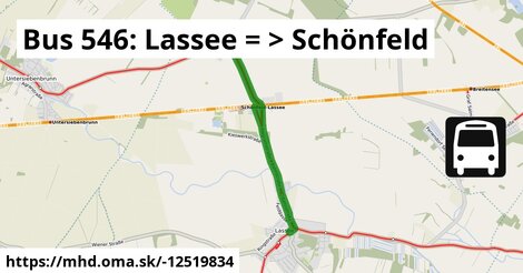
Zastávky na linke
Lassee Kirche po 2 m ¤, Lassee Mittelschule po 0,97 km ¤, Schönfeld im Marchfeld Hauptstraße po 4,7 km ¤Zastávky popri linke:
Lassee Kirche po ¤, Lassee Kirche po 2 m ¤, Lassee Mittelschule po 0,97 km ¤, Lassee Mittelschule po 0,97 km ¤, Lassee Wagramstraße po 2,4 km ¤, Schönfeld im Marchfeld Hauptstraße po 4,7 km ¤, Schönfeld im Marchfeld Hauptstraße po 4,7 km ¤Má spoločné úseky s linkami:
Bus 541: Siebenbrunn-Leopoldsdorf = > Schönfeld-Lassee po 0,99 km ¤ , Bus 541: Straudorf Kirche = > Schönfeld-Lassee po 0,99 km ¤ , Bus 541: Schönfeld-Lassee = > Siebenbrunn-Leopoldsdorf po 2,6 km ¤ , Bus 546: Gänserndorf = > Markthof = > Stopfenreuth po 3,2 km ¤ , Bus 546: Stopfenreuth = > Gänserndorf po 3,2 km ¤ , Bus 541: Siebenbrunn-Leopoldsdorf = > Schönfeld im Marchfeld Hauptstraße po 3,2 km ¤ , Bus 546: Obersiebenbrunn Marktplatz = > Stopfenreuth po 3,2 km ¤ , Bus 540: Schloßhof = > Obersiebenbrunn Marktplatz po 3,2 km ¤ , Bus 540: Wien Hausfeldstraße = > Schloßhof po 3,2 km ¤ , Bus 540: Schloßhof = > Wien Aspern Nord po 3,2 km ¤ , Bus 546: Gänserndorf = > Stopfenreuth po 3,2 km ¤ , Bus 546: Schönfeld im Marchfeld Hauptstraße = > Engelhartstetten Volksschule po 3,2 km ¤Trasa vedie cez obce
Lassee: 4,8 km (100 %),

Podobné linky 546:
ine: Bus 546: Stopfenreuth = > Gänserndorf, , ine: Bus 546: Engelhartstetten Volksschule = > Stopfenreuth, , ine: Bus 546: Schönfeld im Marchfeld Hauptstraße = > Engelhartstetten Volksschule, , ine: Bus 546: Stopfenreuth = > Engelhartstetten Volksschule, , ine: Bus 546: Stopfenreuth = > Markthof, , ine: Bus 546: Stopfenreuth = > Loimersdorf Kirche = > Markthof, , ine: Bus 546: Markthof = > Stopfenreuth, , ine: Bus 546: Obersiebenbrunn Marktplatz = > Stopfenreuth, , ine: Bus 546: Gänserndorf = > Markthof = > Stopfenreuth, , ine: Bus 546: Gänserndorf = > Stopfenreuth,Viac info: aktualizovať mapu, uprav v JOSM (pokročilé), -12519834, stiahni GPX, route: bus, to: Schönfeld im Marchfeld Hauptstraße, from: Lassee Kirche, network: VOR, route name: Bus 546: Lassee => Schönfeld, osm version: 11, osm changeset: 0, osm timestamp: 2025 07 19T08:12:08Z, Q2516485, 2, dlzka: 4750, pocet seg: 1, lon: 16.8148, lat: 48.2452, povodna farba: dr. richard no blaguss,