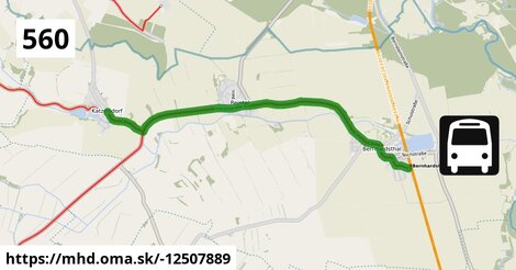
Zastávky na linke
Bernhardsthal Bahnhof po ¤, Bernhardsthal Bahngasse po 439 m ¤, Bernhardsthal Kirche (Gemeindeamt) po 0,87 km ¤, Bernhardsthal Hauptstraße 6/115 po 1,13 km ¤, Bernhardsthal Rotkreuzgasse po 1,53 km ¤, Reintal Ackerberg po 4,4 km ¤, Reintal Meierhofgasse po 4,8 km ¤, Katzelsdorf im Weinviertel Ost po 7,6 km ¤, Katzelsdorf im Weinviertel Ortsmitte po 8,0 km ¤Zastávky popri linke:
Bernhardsthal Bahnhof po ¤, Bernhardsthal Bahngasse po 439 m ¤, Bernhardsthal Bahngasse po 440 m ¤, Bernhardsthal Kirche (Gemeindeamt) po 0,87 km ¤, Bernhardsthal Kirche (Gemeindeamt) po 0,88 km ¤, Bernhardsthal Hauptstraße 6/115 po 1,13 km ¤, Bernhardsthal Hauptstraße 6/115 po 1,13 km ¤, Bernhardsthal Rotkreuzgasse po 1,51 km ¤, Bernhardsthal Rotkreuzgasse po 1,53 km ¤, Reintal Ackerberg po 4,4 km ¤, Reintal Ackerberg po 4,4 km ¤, Reintal Meierhofgasse po 4,8 km ¤, Reintal Meierhofgasse po 4,8 km ¤, Katzelsdorf im Weinviertel Ost po 7,6 km ¤, Katzelsdorf im Weinviertel Ost po 7,6 km ¤, Katzelsdorf im Weinviertel Ortsmitte po 8,0 km ¤, Katzelsdorf im Weinviertel Ortsmitte po 8,0 km ¤Má spoločné úseky s linkami:
Bus 566: Mistelbach Bahnhof = > Bernhardsthal Bahnhof po 1,75 km ¤ , Bus 566: Großkrut Schulen = > Bernhardsthal Bahnhof po 1,75 km ¤ , Bus 566: Bernhardsthal Bahnhof = > Mistelbach Bahnhof po 1,75 km ¤ , Bus 566: Bernhardsthal Bahnhof = > Althöflein Ortsmitte = > Mistelbach Bahnhof po 1,75 km ¤ , Bus 560: Poysdorf Volksschule = > Bernhardsthal Bahnhof po 1,75 km ¤ , Bus 560: Poysdorf Dreifaltigkeitsplatz = > Bernhardsthal Bahnhof po 1,75 km ¤ , Bus 560: Mistelbach Bahnhof = > Bernhardsthal Bahnhof po 1,75 km ¤ , Bus 560: Mistelbach Bahnhof = > Bernhardsthal Kirche (Volksschule) = > Bernhardsthal Bahnhof po 1,75 km ¤ , Bus 560: Bernhardsthal Bahnhof = > Poysdorf Mittelschule po 1,75 km ¤ , Bus 560: Bernhardsthal Bahnhof = > Mistelbach Bahnhof po 1,75 km ¤ , Bus 560: Bernhardsthal Bahnhof = > Mistelbach Alleegasse = > Mistelbach Bahnhof po 1,75 km ¤ , Bus 560: Bernhardsthal Bahnhof = > Bernhardsthal Kirche = > Poysdorf Mittelschule = > Mistelbach Bahnhof po 1,75 km ¤ , Bus 150: Wien Floridsdorf = > Bernhardsthal Bahnhof po 1,75 km ¤ , Bus 150: Bernhardsthal Bahnhof = > Wien Floridsdorf po 1,75 km ¤Trasa vedie cez obce
Bernhardsthal: 8,0 km (100 %),


Podobné linky 560:
ine: Bus 560: Bernhardsthal Bahnhof = > Mistelbach Bahnhof, , ine: Bus 560: Schrattenberg Volksschule = > Herrnbaumgarten Volksschule, , ine: Bus 560: Bernhardsthal Bahnhof = > Bernhardsthal Kirche = > Poysdorf Mittelschule = > Mistelbach Bahnhof, , ine: Bus 560: Mistelbach Bahnhof = > Poysdorf Dreifaltigkeitsplatz, , ine: Bus 560: Poysdorf Dreifaltigkeitsplatz = > Poysdorf Mittelschule = > Mistelbach Bahnhof, , ine: Bus 560: Bernhardsthal Bahnhof = > Mistelbach Alleegasse = > Mistelbach Bahnhof, , ine: Bus 560: Herrnbaumgarten Volksschule = > Schrattenberg Volksschule, , ine: Bus 560: Poysdorf Dreifaltigkeitsplatz = > Mistelbach Bahnhof, , ine: Bus 560: Poysdorf Dreifaltigkeitsplatz = > Bernhardsthal Bahnhof, , ine: Bus 560: Mistelbach Bahnhof = > Bernhardsthal Bahnhof, , ine: Bus 560: Schrattenberg Kirchenplatz = > Mistelbach Bahnhof, , ine: Bus 560: Mistelbach Bahnhof = > Bernhardsthal Kirche (Volksschule) = > Bernhardsthal Bahnhof, , ine: Bus 560: Poysdorf Volksschule = > Bernhardsthal Bahnhof, , ine: Bus 560: Herrnbaumgarten Hauptstraße 5a = > Schrattenberg Volksschule, , ine: Bus 560: Bernhardsthal Bahnhof = > Poysdorf Mittelschule,Viac info: aktualizovať mapu, uprav v JOSM (pokročilé), -12507889, stiahni GPX, route: bus, to: Katzelsdorf im Weinviertel Ortsmitte, from: Bernhardsthal Bahnhof, network: VOR, route name: Bus 560: Bernhardsthal Bahnhof => Katzelsdorf im Weinviertel Ortsmitte, osm version: 4, osm changeset: 0, osm timestamp: 2025 07 09T14:15:51Z, Q2516485, 2, dlzka: 8014, pocet seg: 1, lon: 16.8320, lat: 48.6977, povodna farba: gschwindl komet,