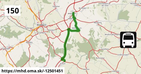
Zastávky popri linke:
Wilfersdorf bei Mistelbach Marktplatz po ¤,
Wilfersdorf bei Mistelbach Marktplatz po 2 m ¤,
Hobersdorf Wiener Straße 14/17 po 607 m ¤,
Hobersdorf Wiener Straße 14/17 po 612 m ¤,
Kettlasbrunn Nord po 2,6 km ¤,
Kettlasbrunn Nord po 2,7 km ¤,
Kettlasbrunn Ortsmitte po 3,6 km ¤,
Kettlasbrunn Ortsmitte po 3,6 km ¤,
Schrick Hobersdorfer Straße po 11,8 km ¤,
Schrick Hobersdorfer Straße po 11,8 km ¤Má spoločné úseky s linkami:
Bus 561: Rabensburg Kirchenplatz = > Mistelbach Bahnhof (via M-City) po 48 m ¤ ,
Bus 561: Rabensburg Kirchenplatz = > Mistelbach Bahnhof (ohne Halt in Ebersdorf, Bullendorf) po 48 m ¤ ,
Bus 561: Hausbrunn Mittelschule = > Mistelbach Bahnhof (via M-City) po 48 m ¤ ,
Bus 561: Großkrut Schulen = > Mistelbach Bahnhof po 48 m ¤ ,
Bus 561: Ebersdorf Bahnstraße = > Mistelbach Bahnhof (via Mistelbach Alleegasse) po 48 m ¤ ,
Bus 562: Mistelbach Bahnhof = > Prinzendorf Feuerwehr po 48 m ¤ ,
Bus 562: Mistelbach Bahnhof = > Hohenau Bahnhof po 48 m ¤ ,
Bus 562: Mistelbach Bahnhof = > Hohenau Bahnhof (via Mistelbach Hauptplatz) po 48 m ¤ ,
Bus 567: Mistelbach Bahnhof = > Zistersdorf Hauptstraße (via M-City) po 48 m ¤ ,
Bus 580: Wildendürnbach Ortsmitte = > Mistelbach Bahnhof po 48 m ¤ ,
Bus 582: Neudorf im Weinviertel Hauptplatz = > Mistelbach Bahnhof po 48 m ¤ ,
Bus 567: Mistelbach Bahnhof = > Zistersdorf Hauptstraße po 48 m ¤ ,
Bus 566: Mistelbach Bahnhof = > Bernhardsthal Bahnhof po 48 m ¤ ,
Bus 566: Bernhardsthal Bahnhof = > Mistelbach Bahnhof po 48 m ¤ ,
Bus 566: Bernhardsthal Bahnhof = > Mistelbach Bahnhof (via Althöflein Ortsmitte) po 48 m ¤ ,
Bus 562: Hohenau Bahnhof = > Mistelbach Bahnhof (ohne Halt in Ebersdorf, Bullendorf) po 48 m ¤ ,
Bus 562: Hohenau Bahnhof = > Mistelbach Bahnhof (via Dobermannsdorf Kirche) po 48 m ¤ ,
Bus 562: Hohenau Bahnhof = > Mistelbach Bahnhof (via Mistelbach Hauptplatz) po 48 m ¤ ,
Bus 562: Hohenau Bahnhof = > Mistelbach Bahnhof po 48 m ¤ ,
Bus 560: Mistelbach Bahnhof = > Poysdorf Dreifaltigkeitsplatz po 48 m ¤ ,
Bus 560: Mistelbach Bahnhof = > Bernhardsthal Bahnhof po 48 m ¤ ,
Bus 560: Mistelbach Bahnhof = > Bernhardsthal Bahnhof (via Bernhardsthal Kirche (Volksschule)) po 48 m ¤ ,
Bus 560: Schrattenberg Kirchenplatz = > Mistelbach Bahnhof po 48 m ¤ ,
Bus 560: Poysdorf Dreifaltigkeitsplatz = > Mistelbach Bahnhof po 48 m ¤ ,
Bus 560: Poysdorf Dreifaltigkeitsplatz = > Mistelbach Bahnhof (via Poysdorf Mittelschule) po 48 m ¤ ,
Bus 560: Bernhardsthal Bahnhof = > Mistelbach Bahnhof po 48 m ¤ ,
Bus 560: Bernhardsthal Bahnhof = > Mistelbach Bahnhof (via Mistelbach Alleegasse) po 48 m ¤ ,
Bus 560: Bernhardsthal Bahnhof = > Mistelbach Bahnhof (via Bernhardsthal Kirche, Poysdorf Mittelschule) po 48 m ¤ ,
Bus 561: Mistelbach Bahnhof = > Rabensburg Kirchenplatz po 48 m ¤ ,
Bus 561: Mistelbach Bahnhof = > Rabensburg Kirchenplatz (via Mistelbach M-City) po 48 m ¤ ,
Bus 561: Mistelbach Bahnhof = > Großkrut Schulen po 48 m ¤ ,
Bus 561: Rabensburg Kirchenplatz = > Mistelbach Bahnhof po 48 m ¤ ,
Bus 567: Zistersdorf Kaiserstraße = > Mistelbach Bahnhof po 48 m ¤ ,
Bus 567: Zistersdorf Kaiserstraße = > Mistelbach Bahnhof (via St. Ulrich Ortsmitte, ohne M-City) po 48 m ¤ ,
Bus 567: Zistersdorf Kaiserstraße = > Mistelbach Bahnhof (via Neusiedl Kirche/Schulen, St. Ulrich Ortsmitte, ohne M-City) po 48 m ¤ ,
Bus 567: Zistersdorf Hauptstraße = > Mistelbach Bahnhof po 48 m ¤ ,
Bus 563: Zistersdorf Hauptstraße = > Mistelbach Bahnhof po 431 m ¤ ,
Bus 563: Drösing Bahnhof = > Mistelbach Bahnhof (via M-City) po 431 m ¤ ,
Bus 563: Drösing Bahnhof = > Mistelbach Bahnhof (via M-City, Mistelbach Hauptplatz) po 431 m ¤ ,
Bus 563: Drösing Bahnhof = > Mistelbach Bahnhof (via M-City, Zistersdorf Schloßplatz) po 431 m ¤ ,
Bus 563: Drösing Bahnhof = > Mistelbach Bahnhof po 431 m ¤ ,
Bus 573: Altlichtenwarth Neusiedler Straße = > Hollabrunn Internat po 431 m ¤ ,
Bus 564: Mistelbach Bahnhof = > Zistersdorf Hauptstraße po 1,02 km ¤ ,
Bus 564: Mistelbach Bahnhof = > Zistersdorf Hauptstraße (ohne Mistelbach Hauptplatz) po 1,02 km ¤ ,
Bus 564: Mistelbach Bahnhof = > Dürnkrut Bahnhof po 1,02 km ¤ ,
Bus 564: Mistelbach Bahnhof = > Dürnkrut Bahnhof (ohne Mistelbach Hauptplatz) po 1,02 km ¤ ,
Bus 564: Mistelbach Bahnhof = > Drösing Bahnhof po 1,02 km ¤ ,
Bus 564: Mistelbach Bahnhof = > Drösing Bahnhof (via Mistelbach Wirtschaftspark) po 1,02 km ¤ ,
Bus 564: Mistelbach Bahnhof = > Drösing Bahnhof (ohne Mistelbach Hauptplatz, Drösing Kaiser-Josef-Platz) po 1,02 km ¤ ,
Bus 564: Mistelbach Bahnhof = > Drösing Bahnhof (ohne Großinzersdorf) po 1,02 km ¤ ,
Bus 573: Hollabrunn Internat = > Altlichtenwarth Neusiedler Straße po 1,02 km ¤ ,
Bus 563: Mistelbach Bahnhof = > Zistersdorf Hauptstraße (via Mistelbach Hauptplatz) po 1,02 km ¤ ,
Bus 563: Mistelbach Bahnhof = > Drösing Bahnhof (via Mistelbach Hauptplatz & M-City) po 1,02 km ¤ ,
Bus 563: Mistelbach Bahnhof = > Zistersdorf Hauptstraße po 1,02 km ¤ ,
Bus 563: Mistelbach Bahnhof = > Drösing Bahnhof po 1,02 km ¤ ,
Bus 563: Mistelbach Bahnhof = > Zistersdorf Hauptstraße (via Zistersdorf Schloßplatz) po 1,02 km ¤ ,
Bus 563: Mistelbach Bahnhof = > Drösing Bahnhof (via Mistelbach M-City) po 1,02 km ¤ ,
Bus 564: Mistelbach Hauptplatz = > Drösing Bahnhof (via Mistelbach Alleegasse) po 1,02 km ¤ ,
Bus 567: Mistelbach Bahnhof = > Zistersdorf Hauptstraße (via Kettlasbrunn) po 1,05 km ¤ ,
Bus 564: Drösing Bahnhof = > Mistelbach Bahnhof (via Drösing Kaiser-Josef-Platz) po 3,3 km ¤ ,
Bus 564: Zistersdorf Hauptstraße = > Mistelbach Bahnhof po 3,3 km ¤ ,
Bus 564: Zistersdorf Hauptstraße = > Mistelbach Bahnhof (via Mistelbach Hauptplatz) po 3,3 km ¤ ,
Bus 564: Kettlasbrunn Ortsmitte = > Mistelbach Bahnhof (via Mistelbach Alleegasse) po 3,3 km ¤ ,
Bus 564: Dürnkrut Bahnhof = > Mistelbach Bahnhof (via Wilfersdorf Wirtschaftspark, Mistelbach Hauptplatz) po 3,3 km ¤ ,
Bus 564: Dürnkrut Bahnhof = > Mistelbach Bahnhof (via Wilfersdorf Wirtschaftspark) po 3,3 km ¤ ,
Bus 564: Drösing Bahnhof = > Mistelbach Bahnhof po 3,3 km ¤ ,
Bus 564: Drösing Bahnhof = > Mistelbach Bahnhof (via Drösing Kaiser-Josef-Platz, Wilfersdorf Wirtschaftspark) po 3,3 km ¤ ,
Bus 564: Drösing Bahnhof = > Mistelbach Bahnhof (ohne Kettlasbrunn) po 5,9 km ¤ ,
Bus 150: Bernhardsthal Bahnhof = > Wien Floridsdorf po 5,9 km ¤ ,
Bus 150: Wien Floridsdorf = > Bernhardsthal Bahnhof po 8,0 km ¤ ,
Bus 535: Gänserndorf Bahnhof = > Mistelbach Bahnhof po 9,5 km ¤ ,
Bus 535: Gänserndorf Bahnhof = > Mistelbach Bahnhof po 9,5 km ¤ ,
Bus 571: Pellendorf Feuerwehr = > Martinsdorf Winzerstraße = > Gaweinstal Volksschule po 10,9 km ¤ ,
Bus 571: Schrick = > Mistelbach Bahnhof (via A5, Gaweinstal, Höbersbrunn) po 10,9 km ¤ ,
Bus 500: Mistelbach Bahnhof = > Wien Floridsdorf po 11,4 km ¤ ,
Bus 565: Mistelbach Bahnhof = > Niedersulz Kirche po 11,4 km ¤ ,
Bus 565: Mistelbach Bahnhof = > Dürnkrut Bahnhof po 11,4 km ¤ ,
Bus 565: Mistelbach Bahnhof = > Dürnkrut Bahnhof (via Niedersulz Museumsdorf) po 11,4 km ¤ ,
Bus 565: Mistelbach Bahnhof = > Spannberg Hauptplatz po 11,4 km ¤ ,
Bus 565: Mistelbach Bahnhof = > Dürnkrut Bahnhof (via Ebenthal) po 11,4 km ¤ ,
Bus 535: Mistelbach Bahnhof = > Gänserndorf Bahnhof po 11,4 km ¤ ,
Bus 500: Wien Floridsdorf = > Mistelbach Bahnhof po 11,7 km ¤ ,
Bus 571: Gaweinstal Hauptplatz = > Pellendorf = > Schrick = > Martinsdorf = > Gaweinstal Hauptplatz po 11,7 km ¤ ,
Bus 565: Niedersulz Kirche = > Mistelbach Bahnhof po 11,7 km ¤ ,
Bus 571: Gaweinstal Hauptplatz = > Martinsdorf = > Schrick = > Ebendorf = > Mistelbach Bahnhof po 11,7 km ¤ ,
Bus 571: Gaweinstal Volksschule = > Martinsdorf Winzerstraße (via Schrick) po 11,7 km ¤ ,
Bus 565: Dürnkrut Bahnhof = > Mistelbach Bahnhof po 11,7 km ¤ ,
Bus 565: Dürnkrut Bahnhof = > Mistelbach Bahnhof (via Niedersulz Museumsdorf) po 11,7 km ¤ Viac info:
aktualizovať mapu,
uprav v JOSM (pokročilé),
-12501451,
stiahni GPX, description: Durchbindung der Linien 150 und 500 in Schrick Hobersdorfer Straße, route: bus, to: Schrick Hobersdorfer Straße, from: Wilfersdorf bei Mistelbach Marktplatz, network: VOR, website: https://www.gschwindl.at/, gtfs:feed: AT VOR, route name: Bus 150: Wilfersdorf bei Mistelbach Marktplatz => Schrick Hobersdorfer Straße, osm version: 11, network:guid: AT VOR, gtfs:route id: at:vor:150:, gtfs:shape id: 66 150 j26 1.3.R, network:short: VOR, osm changeset: 0, osm timestamp: 2025 11 03T05:37:59Z, Q2516485, %66 150 j26 1.3.R, 7.T0.66 150 j26 1.3.R, 2, dlzka: 11812, pocet seg: 1, lon: 16.6378, lat: 48.5529, povodna farba: gschwindl,
Zdroj dát
Mapové údaje pochádzajú z
www.OpenStreetMap.org, databáza je prístupná pod licenciou
ODbL.

Mapový podklad vytvára a aktualizuje
Freemap Slovakia (www.freemap.sk), šíriteľný pod licenciou CC-BY-SA. Fotky sme čerpali z galérie portálu freemap.sk, autori fotiek sú uvedení pri jednotlivých fotkách a sú šíriteľné pod licenciou CC a z wikipédie. Výškový profil trás čerpáme z
SRTM. Niečo vám chýba?
Pridajte to. Sme radi, že tvoríte slobodnú wiki mapu sveta.