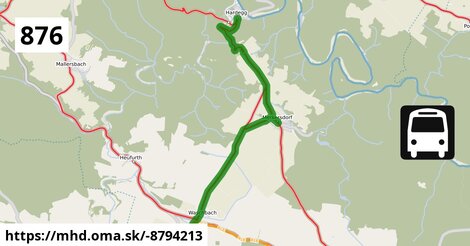
Zastávky popri linke:
Hardegg Burg po 1 m ¤,
Hardegg Burg po 8 m ¤,
Hardegg Nationalparkhaus po 1,88 km ¤,
Merkersdorf/Hardegg Ortsmitte po 3,8 km ¤,
Merkersdorf/Hardegg Ortsmitte po 3,8 km ¤,
Waschbach Kriegerdenkmal po 7,3 km ¤,
Waschbach Kriegerdenkmal po 7,4 km ¤,
Pleißing Volksschule po 7,7 km ¤,
Pleißing Volksschule po 7,7 km ¤Má spoločné úseky s linkami:
Bus 875: Drosendorf Schulen = > Hardegg Burg = > Retz Bahnhof po 1,71 km ¤ ,
Bus 876: Niederfladnitz Kriegerdenkmal = > Heufurth Ortsmitte po 1,71 km ¤ ,
Bus 876: Retz Bahnhof = > Mallersbach Ortsmitte po 1,71 km ¤ ,
Bus 875: Retz Bahnhof = > Hardegg Burg = > Drosendorf Schulen po 1,71 km ¤ ,
Bus 876: Weitersfeld Schule = > Retz Bahnhof po 3,2 km ¤ ,
Bus 876: Weitersfeld im Waldviertel Hauptplatz = > Niederfladnitz Kriegerdenkmal po 3,2 km ¤ ,
Bus 876: Retz Bahnhof = > Rodingersdorf Marktplatz po 3,2 km ¤ ,
Bus 876: Retz Bahnhof = > Weitersfeld im Waldviertel Hauptplatz po 6,9 km ¤ ,
Bus 875: Retz Bahnhof = > Merkersdorf/Hardegg Ortsmitte = > Drosendorf Schulen po 7,5 km ¤ ,
Bus 876: Retz Bahnhof = > Weitersfeld Hauptplatz = > Weitersfeld Schule po 7,5 km ¤ ,
Bus 876: Retz Bahnhof = > Weitersfeld Auberg = > Weitersfeld Schule po 7,5 km ¤ ,
Bus 876: Niederfladnitz Kriegerdenkmal = > Retz Bahnhof po 7,5 km ¤ ,
Bus 875: Drosendorf Schulen = > Retz Bahnhof po 7,5 km ¤ ,
Bus 875: Weitersfeld im Waldviertel Hauptplatz = > Retz Bahnhof po 7,5 km ¤ ,
Bus 876: Hardegg Nationalparkhaus = > Retz Bahnhof po 7,5 km ¤ ,
Bus 875: Retz Bahnhof = > Drosendorf Schulen po 7,5 km ¤ ,
Bus 875: Retz Bahnhof = > Weitersfeld im Waldviertel Hauptplatz po 7,5 km ¤ ,
Bus 876: Pleißing Johannesplatz = > Hardegg Burg po 7,6 km ¤ ,
Bus 876: Weitersfeld Schule = > Felling bei Riegersburg Ortsmitte po 7,6 km ¤ ,
Bus 888: Horn Hauptplatz = > Horn Mittelschule = > Retz Bahnhof po 7,6 km ¤ ,
Bus 888: Horn Hauptplatz = > Retz Bahnhof po 7,6 km ¤ ,
Bus 888: Retz Bahnhof = > Horn Hauptplatz po 7,6 km ¤ ,
Bus 876: Retz Bahnhof = > Weitersfeld Schule po 7,7 km ¤ ,
Bus 876: Retz Bahnhof = > Horn Volksschule/AHS po 7,7 km ¤ ,
Bus 876: Retz Bahnhof = > Horn Hauptplatz po 7,7 km ¤ ,
Bus 876: Retz Bahnhof = > Pleißing Volksschule po 7,7 km ¤ Podobné linky 876:
ine: Bus 876: Retz Bahnhof = > Weitersfeld Schule, ,
ine: Bus 876: Weitersfeld im Waldviertel Hauptplatz = > Walkenstein Ortsmitte, ,
ine: Bus 876: Weitersfeld Schule = > Retz Bahnhof, ,
ine: Bus 876: Niederfladnitz Kriegerdenkmal = > Heufurth Ortsmitte, ,
ine: 876: Szentendre, autóbusz-állomás = > Szentendre, Püspökmajori lakótelep = > Szentendre, Sportpálya = > Szentendre, Szarvashegytelep = > Szentendre, autóbusz-állomás, ,
ine: Bus 876: Retz Bahnhof = > Weitersfeld im Waldviertel Hauptplatz, ,
ine: Bus 876: Hardegg Nationalparkhaus = > Retz Bahnhof, ,
ine: Bus 876: Niederfladnitz Kriegerdenkmal = > Retz Bahnhof, ,
ine: Bus 876: Retz Bahnhof = > Weitersfeld Auberg = > Weitersfeld Schule, ,
ine: Bus 876: Retz Bahnhof = > Rodingersdorf Marktplatz, ,
ine: Bus 876: Retz Bahnhof = > Weitersfeld Hauptplatz = > Weitersfeld Schule, ,
ine: Bus 876: Retz Bahnhof = > Pleißing Volksschule, ,
ine: Bus 876: Retz Bahnhof = > Mallersbach Ortsmitte, ,
ine: Bus 876: Pleißing Johannesplatz = > Hardegg Burg, ,
ine: Bus 876: Weitersfeld im Waldviertel Hauptplatz = > Niederfladnitz Kriegerdenkmal, ,
ine: Bus 876: Retz Bahnhof = > Horn Hauptplatz, ,
ine: Bus 876: Retz Bahnhof = > Horn Volksschule/AHS, ,
ine: Bus 876: Weitersfeld Schule = > Felling bei Riegersburg Ortsmitte,
Viac info:
aktualizovať mapu,
uprav v JOSM (pokročilé),
-8794213,
stiahni GPX, route: bus, to: Pleißing Volksschule, from: Hardegg Burg, network: VOR, gtfs:feed: AT VOR, route name: Bus 876: Hardegg Burg => Pleißing Volksschule, osm version: 9, gtfs:route id: at:vor:876:, osm changeset: 0, osm timestamp: 2025 11 16T10:17:19Z, Q2516485, 2, dlzka: 7736, pocet seg: 1, lon: 15.8595, lat: 48.8310, povodna farba: osterreichische postbus a,
Zdroj dát
Mapové údaje pochádzajú z
www.OpenStreetMap.org, databáza je prístupná pod licenciou
ODbL.

Mapový podklad vytvára a aktualizuje
Freemap Slovakia (www.freemap.sk), šíriteľný pod licenciou CC-BY-SA. Fotky sme čerpali z galérie portálu freemap.sk, autori fotiek sú uvedení pri jednotlivých fotkách a sú šíriteľné pod licenciou CC a z wikipédie. Výškový profil trás čerpáme z
SRTM. Niečo vám chýba?
Pridajte to. Sme radi, že tvoríte slobodnú wiki mapu sveta.