Cesta: OMA » Doprava » iná » bus » Bus 878: Retz Bahnhof = > Eggenburg Hauptplatz

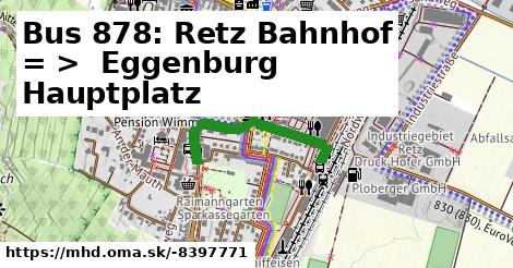
Bus 878: Retz Bahnhof = > Eggenburg Hauptplatz

dĺžka 570 m , spravuje Österreichische Postbus AG, číslo trasy 878, názvy: Bus 878: Retz Bahnhof => Eggenburg Hauptplatz

Zastávky na linke

autobusová zastávka po 2 m ¤

Zastávky popri linke:

autobusová zastávka po 2 m ¤, autobusová zastávka po 17 m ¤, autobusová zastávka po 27 m ¤

prestupné linky:

Bus 875: Drosendorf Schulen = > Hardegg Burg = > Retz Bahnhof po ¤, Bus 888: Horn Hauptplatz = > Retz Bahnhof po ¤, Bus 875: Drosendorf Schulen = > Retz Bahnhof po ¤, Bus 875: Weitersfeld Hauptplatz = > Retz Bahnhof po ¤, Bus 888: Horn Hauptplatz = > Horn Mittelschule = > Retz Bahnhof po ¤, Bus 815: Alberndorf im Pulkautal Gemeindeamt = > Retz Bahnhof po ¤, Bus 815: Haugsdorf Mittelschule = > Retz Bahnhof po ¤, Bus 815: Jetzelsdorf Kriegerdenkmal = > Pfaffendorf Franz-Ecker-Siedlung = > Retz Schulen = > Retz Bahnhof po ¤, Bus 815: Jetzelsdorf Kriegerdenkmal = > Retz Schulen = > Retz Bahnhof po ¤, Bus 815: Jetzelsdorf Kriegerdenkmal = > Retz Bahnhof po ¤, Bus 815: Jetzelsdorf Kriegerdenkmal = > Retz Bahnhof (über Retz Schulen, nicht über Pfaffendorf Kirchenplatz) po ¤, Bus 815: Kleinriedenthal Ort = > Retz Bahnhof po ¤, Bus 815: Unterretzbach Bahnstraße = > Retz Bahnhof po ¤, Bus 815: Kleinriedenthal Ort = > Kleinhöflein bei Retz Ort = > Retz Bahnhof po ¤, Bus 876: Weitersfeld Schule = > Retz Bahnhof po 315 m ¤, Bus 876: Niederfladnitz Kriegerdenkmal = > Retz Bahnhof po 315 m ¤, Bus 876: Hardegg Nationalparkhaus = > Retz Bahnhof po 315 m ¤

Má spoločné úseky s linkami:

Bus 876: Retz Bahnhof = > Weitersfeld Auberg = > Weitersfeld Schule po 12 m ¤ , Bus 876: Retz Bahnhof = > Mallersbach Ortsmitte po 12 m ¤ , Bus 876: Retz Bahnhof = > Rodingersdorf Marktplatz po 12 m ¤ , Bus 876: Retz Bahnhof = > Pleißing Volksschule po 12 m ¤ , Bus 876: Retz Bahnhof = > Horn Hauptplatz po 12 m ¤ , Bus 876: Retz Bahnhof = > Horn Volksschule/AHS po 12 m ¤ , Bus 875: Retz Bahnhof = > Weitersfeld Hauptplatz po 12 m ¤ , Bus 876: Retz Bahnhof = > Weitersfeld Schule po 12 m ¤ , Bus 875: Retz Bahnhof = > Hardegg Burg = > Drosendorf Schulen po 12 m ¤ , Bus 875: Retz Bahnhof = > Drosendorf Schulen po 12 m ¤ , Bus 876: Retz Bahnhof = > Weitersfeld Hauptplatz po 12 m ¤ , Bus 875: Retz Bahnhof = > Merkersdorf/Hardegg Ortsmitte = > Drosendorf Schulen po 12 m ¤ , Bus 815: Retz Bahnhof = > Jetzelsdorf Kriegerdenkmal po 12 m ¤ , Bus 815: Retz Bahnhof = > Pfaffendorf Kirchenplatz = > Jetzelsdorf Kriegerdenkmal po 12 m ¤ , Bus 814: Hollabrunn Kirchenplatz = > Retz Bahnhof po 12 m ¤ , Bus 876: Retz Bahnhof = > Weitersfeld Hauptplatz = > Weitersfeld Schule po 12 m ¤ , Bus 888: Retz Bahnhof = > Horn Hauptplatz po 275 m ¤ , Bus 878: Retz Bahnhof = > Pulkau Hauptplatz po 291 m ¤ , Bus 877: Watzelsdorf Ort = > Pillersdorf Landesstraße = > Retz Bahnhof po 291 m ¤ , Bus 877: Retz Bahnhof = > Zellerndorf Raifeisenkasse = > Zellerndorf Bahnhof po 291 m ¤ , Bus 877: Retz Bahnhof = > Zellerndorf Schulen = > Zellerndorf Bahnhof po 291 m ¤ , Bus 877: Retz Bahnhof = > Pillersdorf Landesstraße = > Retz Bahnhof po 291 m ¤ , Bus 877: Retz Bahnhof = > Unternalb Hauptstraße Süd = > Retz Bahnhof po 291 m ¤ , Bus 877: Retz Bahnhof = > Pulkau Hauptplatz po 291 m ¤ , Bus 877: Retz Schulen = > Zellerndorf Raifeisenkasse = > Zellerndorf Bahnhof po 291 m ¤ , Bus 877: Retz Bahnhof = > Rohrendorf/Pulkau Ortsmitte = > Pulkau Hauptplatz po 291 m ¤ , Bus 877: Retz Bahnhof = > Unternalb Hauptstraße Süd = > Pulkau Hauptplatz po 291 m ¤ , Bus 877: Retz Bahnhof = > Pulkau Hauptplatz po 291 m ¤ , Bus 878: Retz Bahnhof = > Obernalb Retzer Straße = > Eggenburg Bahnhof po 291 m ¤ , Bus 878: Retz Bahnhof = > Unternalb Hauptstraße Süd = > Eggenburg Bahnhof po 291 m ¤ , Bus 878: Retz Bahnhof = > Unternalb Hauptstraße Süd = > Pulkau Hauptplatz po 291 m ¤ , Bus 878: Retz Bahnhof = > Unternalb Hauptstraße Süd = > Stoitzendorf Ort po 291 m ¤ , Bus 878: Eggenburg Hauptplatz = > Retz Schulen = > Retz Bahnhof po 291 m ¤ , Bus 878: Eggenburg Bahnhof = > Retz Bahnhof (über Gauderndorf Bundesstraße, Pillersdorf Landesstraße und Retz Schulen) po 291 m ¤ , Bus 878: Großreipersdorf Ortsmitte = > Retz Bahnhof po 291 m ¤ , Bus 814: Retz Bahnhof = > Obernalb Retzer Straße = > Hollabrunn Bahnhof po 291 m ¤ , Bus 814: Retz Bahnhof = > Hollabrunn Koliskoplatz po 291 m ¤ , Bus 814: Retz Bahnhof = > Unternalb Hauptstraße Süd = > Hollabrunn Bahnhof po 291 m ¤ , Bus 878: Eggenburg Bahnhof = > Eggenburg Grafenberger Straße/Firma Killer = > Retz Bahnhof po 570 m ¤ , Bus 877: Zellerndorf Bahnhof = > Retz Bahnhof po 570 m ¤ , Bus 877: Watzelsdorf Ort = > Retz Schulen po 570 m ¤ , Bus 877: Watzelsdorf Ort = > Schrattenthal Friedhof = > Retz Bahnhof po 570 m ¤ , Bus 878: Eggenburg Bahnhof = > Gauderndorf Bundesstraße = > Retz Bahnhof po 570 m ¤ , Bus 878: Eggenburg Bahnhof = > Stoitzendorf Bundesstraße = > Retz Bahnhof po 570 m ¤ , Bus 878: Eggenburg Hauptplatz = > Eggenburg Grafenberger Straße/Firma Killer = > Pillersdorf Landesstraße = > Retz Bahnhof po 570 m ¤ , Bus 878: Eggenburg Bahnhof = > Gauderndorf Bundesstraße = > Pillersdorf Landesstraße = > Retz Bahnhof po 570 m ¤ , Bus 878: Eggenburg Bahnhof = > Eggenburg Grafenberger Straße/Firma Killer = > Pillersdorf Landesstraße = > Retz Bahnhof po 570 m ¤ , Bus 878: Eggenburg Bahnhof = > Stoitzendorf Bundesstraße = > Waitzendorf bei Retz Ort = > Retz Bahnhof po 570 m ¤ , Bus 878: Pulkau Hauptplatz = > Retz Bahnhof po 570 m ¤

Podobné linky 878:

ine: Bus 878: Eggenburg Hauptplatz = > Eggenburg Grafenberger Straße/Firma Killer = > Pillersdorf Landesstraße = > Retz Bahnhof, , ine: Bus 878: Retz Bahnhof = > Pulkau Hauptplatz, , ine: Bus 878: Eggenburg Hauptplatz = > Retz Schulen = > Retz Bahnhof, , ine: Bus 878: Eggenburg Bahnhof = > Eggenburg Grafenberger Straße/Firma Killer = > Retz Bahnhof, , ine: Bus 878: Pulkau Hauptplatz = > Retz Bahnhof, , ine: Bus 878: Eggenburg Bahnhof = > Gauderndorf Bundesstraße = > Retz Bahnhof, , ine: Bus 878: Großreipersdorf Ortsmitte = > Retz Bahnhof, , ine: Bus 878: Retz Bahnhof = > Unternalb Hauptstraße Süd = > Eggenburg Bahnhof, , ine: Bus 878: Eggenburg Bahnhof = > Eggenburg Grafenberger Straße/Firma Killer = > Pillersdorf Landesstraße = > Retz Bahnhof, , ine: Bus 878: Eggenburg Bahnhof = > Stoitzendorf Bundesstraße = > Waitzendorf bei Retz Ort = > Retz Bahnhof, , ine: Bus 878: Retz Bahnhof = > Unternalb Hauptstraße Süd = > Stoitzendorf Ort, , ine: Bus 878: Eggenburg Bahnhof = > Stoitzendorf Bundesstraße = > Retz Bahnhof, , ine: Bus 878: Eggenburg Bahnhof = > Retz Bahnhof (über Gauderndorf Bundesstraße, Pillersdorf Landesstraße und Retz Schulen), , ine: Bus 878: Retz Bahnhof = > Obernalb Retzer Straße = > Eggenburg Bahnhof, , ine: 878: Szentendre, autóbusz-állomás = > Szentendre, Sportpálya = > Szentendre, Szarvashegytelep = > Szentendre, autóbusz-állomás, , ine: Bus 878: Eggenburg Bahnhof = > Gauderndorf Bundesstraße = > Pillersdorf Landesstraße = > Retz Bahnhof, , ine: Bus 878: Retz Bahnhof = > Unternalb Hauptstraße Süd = > Pulkau Hauptplatz,
Viac info: aktualizovať mapu, uprav v JOSM (pokročilé), -8397771,
Súradnice: 48°45'17"N, 15°57'16"E
stiahni GPX, route: bus, to: Eggenburg Hauptplatz, from: Retz Bahnhof, network: VOR, route name: Bus 878: Retz Bahnhof => Eggenburg Hauptplatz, osm version: 20, osm changeset: 0, osm timestamp: 2025 09 09T12:16:41Z, Q2516485, 2, dlzka: 570, pocet seg: 1, lon: 15.9545, lat: 48.7549, povodna farba: osterreichische postbus a,
Bus 878: Retz Bahnhof = >  Eggenburg Hauptplatz

Viac o nás

Podpor projekt OMA:

QR kód na túto stránku mhd.oma.sk -8397771

Spojte sa s nami na facebooku, zdieľajte túto stránku na Facebooku, na Twittri, alebo umiestnite odkaz na svoju stránku.

Ale hlavne doplňte dáta do Openstreetmap, články do wikipédie, ...

Zdroj dát

Mapové údaje pochádzajú z www.OpenStreetMap.org, databáza je prístupná pod licenciou ODbL. OMA logoMapový podklad vytvára a aktualizuje Freemap Slovakia (www.freemap.sk), šíriteľný pod licenciou CC-BY-SA. Fotky sme čerpali z galérie portálu freemap.sk, autori fotiek sú uvedení pri jednotlivých fotkách a sú šíriteľné pod licenciou CC a z wikipédie. Výškový profil trás čerpáme z SRTM. Niečo vám chýba? Pridajte to. Sme radi, že tvoríte slobodnú wiki mapu sveta.