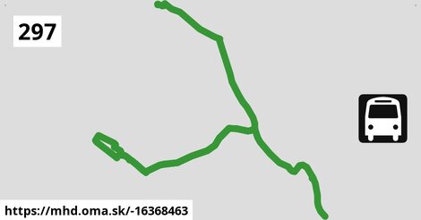
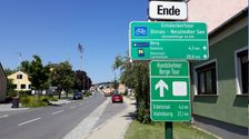
Zastávky na linke
Kittsee Bahnhof po ¤, Kittsee Untere Hauptstraße po 592 m ¤, Kittsee Hauptplatz po 1,04 km ¤, Kittsee Schloss po 1,64 km ¤, Berg bei Wolfsthal Hauptstraße po 3,5 km ¤, Berg bei Wolfsthal Friedhofgasse po 4,4 km ¤, Berg bei Wolfsthal Friedhofgasse po 4,4 km ¤, Edelstal Sportplatz po 8,4 km ¤, Edelstal Siedlung po 9,0 km ¤, Edelstal Hauptstraße po 9,9 km ¤, Berg bei Wolfsthal Volksschule po 14,4 km ¤, Berg bei Wolfsthal Volksschule po 14,4 km ¤, Berg bei Wolfsthal Hauptstraße po 14,9 km ¤, Wolfsthal Am Friedhof po 19 km ¤, Wolfsthal Bahnhof po 20 km ¤Zastávky popri linke:
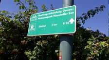
Kittsee Bahnhof po ¤, Kittsee Bahnhof po ¤, Kittsee Untere Hauptstraße po 592 m ¤, Kittsee Untere Hauptstraße po 619 m ¤, Kittsee Hauptplatz po 1,03 km ¤, Kittsee Hauptplatz po 1,04 km ¤, Kittsee Krankenhaus po 1,17 km ¤, Kittsee Schloss po 1,64 km ¤, Kittsee Schloss po 1,65 km ¤, Berg bei Wolfsthal Hauptstraße po 3,5 km ¤, Berg bei Wolfsthal Friedhofgasse po 4,4 km ¤, Berg bei Wolfsthal Friedhofgasse po 4,4 km ¤, Edelstal Sportplatz po 8,4 km ¤, Edelstal Siedlung po 9,0 km ¤, Edelstal Hauptstraße po 9,9 km ¤, Berg bei Wolfsthal Volksschule po 14,4 km ¤, Berg bei Wolfsthal Volksschule po 14,4 km ¤, Berg bei Wolfsthal Hauptstraße po 14,9 km ¤, Wolfsthal Am Friedhof po 19 km ¤, Wolfsthal Am Friedhof po 19 km ¤, Wolfsthal po 20 km ¤, Wolfsthal Bahnhof po 20 km ¤Má spoločné úseky s linkami:
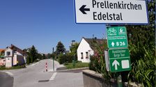
Bus 299: Edelstal Sportplatz = > Gattendorf Kittseer Straße = > Neusiedl am See Schulzentrum po 0,98 km ¤ , Bus 297: Wolfsthal Bahnhof = > Kittsee Bahnhof po 0,98 km ¤ , Bus 299: Kittsee Bahnhof = > Zurndorf Gemeindeamt po 1,30 km ¤ , Bus 299: Kittsee Bahnhof = > Kittsee Schulen = > Zurndorf Obere Hauptstraße po 1,30 km ¤ , Bus 299: Kittsee Bahnhof = > Kittsee Fachmarktzentrum = > Zurndorf Obere Hauptstraße po 1,30 km ¤ , Bus 299: Kittsee Bahnhof = > Gattendorf Kittseer Straße = > Neusiedl am See Schulzentrum po 1,30 km ¤ , Bus 299: Kittsee Bahnhof = > Gattendorf Kittseer Straße = > Potzneusiedl Siedlung = > Parndorf Meierhofgasse = > Neusiedl am See Hauptplatz po 1,30 km ¤ , Bus 299: Kittsee Bahnhof = > Kittsee Fachmarktzentrum = > Zurndorf Neue Mittelschule = > Potzneusiedl Siedlung = > Parndorf Meierhofgasse = > Neusiedl am See Pannonia Shopping Park = > Neusiedl am See Hauptplatz po 1,30 km ¤ , Bus 299: Kittsee Bahnhof = > Kittsee Fachmarktzentrum = > Potzneusiedl Siedlung = > Parndorf Meierhofgasse = > Neusiedl am See Pannonia Shopping Park = > Neusiedl am See Hauptplatz po 1,30 km ¤ , Bus 299: Kittsee Bahnhof = > Kittsee Fachmarktzentrum = > Parndorf Meierhofgasse = > Neusiedl am See Pannonia Shopping Park = > Neusiedl am See Hauptplatz po 1,30 km ¤ , Bus 299: Kittsee Bahnhof = > Zurndorf Neue Mittelschule = > Neudorf bei Parndorf Kriegerdenkmal = > Neusiedl am See Schulzentrum po 1,30 km ¤ , Bus 299: Neusiedl am See Schulzentrum = > Neusiedl am See Pannonia Shopping Park = > Potzneusiedl Siedlung = > Kittsee Fachmarktzentrum = > Kittsee Bahnhof po 1,30 km ¤ , Bus 299: Neusiedl am See Hauptplatz = > Potzneusiedl Siedlung = > Zurndorf Neue Mittelschule = > Kittsee Schulen = > Kittsee Bahnhof po 1,30 km ¤ , Bus 299: Neusiedl am See Hauptplatz = > Neusiedl am See Pannonia Shopping Park = > Potzneusiedl Siedlung = > Kittsee Fachmarktzentrum = > Kittsee Bahnhof po 1,30 km ¤ , Bus 299: Neusiedl am See Hauptplatz = > Kittsee Bahnhof (über Neusiedl am See Pannonia Shopping Park, Potzneusiedl Siedlung, Gattendorf Kittseer Straße und Kittsee Fachmarktzentrum, nicht über Pama und Zurndorf) po 1,30 km ¤ , Bus 299: Neusiedl am See Schulzentrum = > Neusiedl am See Pannonia Shopping Park = > Zurndorf Neue Mittelschule = > Kittsee Bahnhof po 1,30 km ¤ , Bus 299: Neusiedl am See Hauptplatz = > Neusiedl am See Pannonia Shopping Park = > Kittsee Fachmarktzentrum = > Kittsee Bahnhof po 1,30 km ¤ , Bus 299: Neusiedl am See Hauptplatz = > Neusiedl am See Pannonia Shopping Park = > Kittsee Bahnhof po 1,30 km ¤ , Bus 299: Zurndorf Neue Mittelschule = > Kittsee Schulen = > Kittsee Bahnhof po 1,30 km ¤ , Bus 299: Zurndorf Gemeindeamt = > Kittsee Bahnhof po 1,30 km ¤ , Bus 299: Zurndorf Gemeindeamt = > Kittsee Fachmarktzentrum = > Kittsee Bahnhof po 1,30 km ¤ , Bus 299: Zurndorf Neue Mittelschule = > Kittsee Bahnhof po 1,30 km ¤ , Bus 299: Kittsee Bahnhof = > Parndorf Meierhofgasse = > Neusiedl am See Hauptplatz po 1,30 km ¤ , Bus 299: Kittsee Bahnhof = > Kittsee Schulen = > Kittsee Fachmarktzentrum = > Zurndorf Neue Mittelschule = > Potzneusiedl Siedlung = > Parndorf Meierhofgasse = > Neusiedl am See Pannonia Shopping Park = > Neusiedl am See Hauptplatz po 1,30 km ¤ , Bus 299: Neusiedl am See Schulzentrum = > Neusiedl am See Pannonia Shopping Park = > Potzneusiedl Siedlung = > Zurndorf Neue Mittelschule = > Kittsee Fachmarktzentrum = > Kittsee Bahnhof po 1,30 km ¤ , Bus 297: Wolfsthal Bahnhof = > Edelstal Hauptstraße po 9,3 km ¤ , Bus 297: Hainburg an der Donau Ungartor/B9 = > Edelstal Siedlung = > Kittsee Bahnhof po 9,3 km ¤ , Bus 297: Hainburg an der Donau Wiener Tor = > Edelstal Siedlung = > Kittsee Bahnhof po 9,3 km ¤ , Bus 297: Wolfsthal Bahnhof = > Edelstal Siedlung = > Kittsee Bahnhof po 9,3 km ¤ , Bus 297: Wolfsthal Bahnhof = > Edelstal Siedlung = > Kittsee Schulen = > Kittsee Bahnhof po 9,3 km ¤ , Bus 297: Hainburg an der Donau Wiener Tor = > Kittsee Bahnhof po 17 km ¤ , Bus 297: Kittsee Bahnhof = > Hainburg an der Donau Hauptplatz po 17 km ¤ , Bus 297: Kittsee Bahnhof = > Wolfsthal Bahnhof po 17 km ¤ , Bus 297: Hainburg an der Donau Ungartor/B9 = > Kittsee Bahnhof po 17 km ¤ , Bus 297: Kittsee Bahnhof = > Kittsee Schulen = > Edelstal Siedlung = > Wolfsthal Bahnhof po 17 km ¤ , Bus 297: Kittsee Bahnhof = > Edelstal Siedlung = > Hainburg an der Donau Hauptplatz po 17 km ¤ , Bus 297: Kittsee Bahnhof = > Edelstal Siedlung = > Hainburg an der Donau Ungartor/B9 po 17 km ¤ , Bus 901: Hainburg/Donau = > Bratislava po 19 km ¤ , Bus 901: Bratislava = > Hainburg/Donau po 19 km ¤Trasa vedie cez obce
Berg: 4,3 km (21.9 %), Edelstal: 3,8 km (19.2 %), Kittsee: 3,7 km (19 %), Gemeinde Wolfsthal: 3,6 km (18.4 %),


Podobné linky 297:
ine: Bus 297: Hainburg an der Donau Ungartor/B9 = > Edelstal Siedlung = > Kittsee Bahnhof, , ine: Bus 297: Wolfsthal Bahnhof = > Edelstal Hauptstraße, , ine: Bus 297: Kittsee Bahnhof = > Wolfsthal Bahnhof, , ine: Bus 297: Wolfsthal Bahnhof = > Kittsee Bahnhof, , ine: Bus 297: Hainburg an der Donau Wiener Tor = > Kittsee Bahnhof, , ine: Bus 297: Hainburg an der Donau Ungartor/B9 = > Kittsee Bahnhof, , ine: Bus 297: Kittsee Bahnhof = > Hainburg an der Donau Hauptplatz, , ine: Bus 297: Kittsee Bahnhof = > Edelstal Siedlung = > Hainburg an der Donau Hauptplatz, , ine: Bus 297: Wolfsthal Bahnhof = > Edelstal Siedlung = > Kittsee Bahnhof, , ine: Bus 297: Hainburg an der Donau Wiener Tor = > Edelstal Siedlung = > Kittsee Bahnhof, , ine: Bus 297: Wolfsthal Bahnhof = > Edelstal Siedlung = > Kittsee Schulen = > Kittsee Bahnhof, , ine: Bus 297: Kittsee Bahnhof = > Kittsee Schulen = > Edelstal Siedlung = > Wolfsthal Bahnhof, , ine: Bus 297: Kittsee Bahnhof = > Edelstal Siedlung = > Hainburg an der Donau Ungartor/B9,Viac info: aktualizovať mapu, uprav v JOSM (pokročilé), -16368463, stiahni GPX, route: bus, to: Wolfsthal Bahnhof, via: Edelstal Siedlung, from: Kittsee Bahnhof, network: VOR, route name: Bus 297: Kittsee Bahnhof => Edelstal Siedlung => Wolfsthal Bahnhof, osm version: 6, osm changeset: 0, osm timestamp: 2025 11 11T15:42:43Z, Q2516485, 2, dlzka: 19610, pocet seg: 1, lon: 17.0242, lat: 48.1033, povodna farba: osterreichische postbus a,