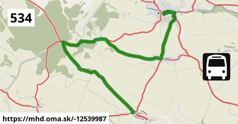
Zastávky na linke
autobusová zastávka po ¤, Zistersdorf Hauptstraße po 366 m ¤, Zistersdorf Neustiftgasse po 1,04 km ¤, Großinzersdorf Ortsmitte po 2,8 km ¤, Großinzersdorf Gaiselberger Straße po 3,6 km ¤, Gaiselberg Ortsmitte po 6,5 km ¤, Blumenthal Kirche po 10,3 km ¤, Loidesthal Lagerhausstraße po 13,9 km ¤Zastávky popri linke:
autobusová zastávka po ¤, Zistersdorf Hauptstraße po 351 m ¤, Zistersdorf Hauptstraße po 366 m ¤, Zistersdorf Neustiftgasse po 1,03 km ¤, Zistersdorf Neustiftgasse po 1,04 km ¤, Großinzersdorf Ortsmitte po 2,8 km ¤, Großinzersdorf Ortsmitte po 2,8 km ¤, Großinzersdorf Gaiselberger Straße po 3,6 km ¤, Großinzersdorf Gaiselberger Straße po 3,6 km ¤, Gaiselberg Ortsmitte po 6,5 km ¤, Gaiselberg Ortsmitte po 6,6 km ¤, Blumenthal Kirche po 10,3 km ¤, Loidesthal Lagerhausstraße po 13,9 km ¤, Loidesthal Lagerhausstraße po 13,9 km ¤Má spoločné úseky s linkami:
Bus 567: Zistersdorf Kaiserstraße = > Prinzendorf Sinngasse po 22 m ¤ , Bus 505: Wien Floridsdorf = > Niedersulz Museumsdorf = > Obersulz Ortsmitte = > Zistersdorf Schloßplatz po 22 m ¤ , Bus 534: Zistersdorf Schloßplatz = > Loidesthal Hauptstraße po 22 m ¤ , Bus 534: Matzen Schule = > Zistersdorf Schloßplatz po 22 m ¤ , Bus 534: Gänserndorf Bahnhof = > Zistersdorf Schloßplatz po 22 m ¤ , Bus 567: Gösting Palterndorfer Straße = > Zistersdorf Kaiserstraße po 22 m ¤ , Bus 567: Zistersdorf Schloßplatz = > Wilfersdorf bei Mistelbach Marktplatz po 22 m ¤ , Bus 567: Zistersdorf Schloßplatz = > Ringelsdorf Obere Hauptstraße po 22 m ¤ , Bus 505: Wien Floridsdorf = > Obersulz Ortsmitte = > Zistersdorf Schloßplatz po 22 m ¤ , Bus 567: Zistersdorf Kaiserstraße = > Mistelbach Bahnhof po 22 m ¤ , Bus 567: Zistersdorf Kaiserstraße = > St. Ulrich Ortsmitte = > Mistelbach Bahnhof (ohne M-City) po 22 m ¤ , Bus 567: Zistersdorf Kaiserstraße = > Neusiedl Kirche/Schulen = > St. Ulrich Ortsmitte = > Mistelbach Bahnhof (ohne M-City) po 22 m ¤ , Bus 564: Zistersdorf Schloßplatz = > Drösing Bahnhof (ohne Drösing Kaiser-Josef-Platz) po 22 m ¤ , Bus 564: Gaiselberg Ortsmitte = > Zistersdorf Schloßplatz po 22 m ¤ , Bus 568: Poysdorf Dreifaltigkeitsplatz = > Zistersdorf Kaiserstraße po 22 m ¤ , Bus 568: Zistersdorf Kaiserstraße = > Poysdorf Dreifaltigkeitsplatz po 22 m ¤ , Bus 568: Zistersdorf Schloßplatz = > Poysdorf Dreifaltigkeitsplatz po 22 m ¤ , Bus 564: Drösing Bahnhof = > Zistersdorf Kaiserstraße (ohne Großinzersdorf) po 22 m ¤ , Bus 505: Wien Floridsdorf = > Niedersulz Museumsdorf = > Zistersdorf Schloßplatz po 22 m ¤ , Bus 505: Wien Floridsdorf = > Zistersdorf Schloßplatz po 22 m ¤ , Bus 505: Wolkersdorf Bahnhof = > Niedersulz Museumsdorf = > Zistersdorf Schloßplatz po 22 m ¤ , Bus 505: Wolkersdorf Bahnhof = > Zistersdorf Schloßplatz po 22 m ¤ , Bus 563: Drösing Bahnhof = > Zistersdorf Schloßplatz = > Zistersdorf Kaiserstraße po 22 m ¤ , Bus 563: Mistelbach Bahnhof = > Zistersdorf Schloßplatz = > Zistersdorf Hauptstraße po 22 m ¤ , Bus 563: Drösing Bahnhof = > Schloßplatz = > Zistersdorf Kaiserstraße po 22 m ¤ , Bus 563: Drösing Bahnhof = > M-City = > Zistersdorf Schloßplatz = > Mistelbach Bahnhof po 22 m ¤ , Bus 563: Mistelbach Bahnhof = > Zistersdorf Hauptstraße po 366 m ¤ , Bus 563: Mistelbach Bahnhof = > Mistelbach Hauptplatz = > Zistersdorf Hauptstraße po 366 m ¤ , Bus 563: Zistersdorf Hauptstraße = > Drösing Bahnhof po 547 m ¤ , Bus 563: Drösing Bahnhof = > Zistersdorf Feuerwehr po 547 m ¤ , Bus 567: Mistelbach Bahnhof = > Zistersdorf Hauptstraße po 547 m ¤ , Bus 567: Mistelbach Bahnhof = > M-City = > Zistersdorf Hauptstraße po 547 m ¤ , Bus 567: Mistelbach Bahnhof = > Kettlasbrunn = > Zistersdorf Hauptstraße po 547 m ¤ , Bus 563: Drösing Bahnhof = > M-City = > Mistelbach Hauptplatz = > Mistelbach Bahnhof po 547 m ¤ , Bus 563: Mistelbach Bahnhof = > Mistelbach M-City = > Drösing Bahnhof po 547 m ¤ , Bus 563: Mistelbach Bahnhof = > Drösing Bahnhof po 547 m ¤ , Bus 563: Drösing Bahnhof = > Mistelbach Bahnhof po 547 m ¤ , Bus 563: Mistelbach Bahnhof = > Mistelbach Hauptplatz = > M-City = > Drösing Bahnhof po 547 m ¤ , Bus 563: Drösing Bahnhof = > M-City = > Mistelbach Bahnhof po 547 m ¤ , Bus 567: Zistersdorf Hauptstraße = > Mistelbach Bahnhof po 547 m ¤ , Bus 573: Hollabrunn Internat = > Altlichtenwarth Neusiedler Straße po 0,73 km ¤ , Bus 573: Altlichtenwarth Neusiedler Straße = > Hollabrunn Internat po 0,73 km ¤ , Bus 534: Zistersdorf Schloßplatz = > Gänserndorf Bahnhof po 3,5 km ¤ , Bus 564: Mistelbach Bahnhof = > Zistersdorf Hauptstraße (ohne Mistelbach Hauptplatz) po 7,3 km ¤ , Bus 564: Mistelbach Bahnhof = > Zistersdorf Hauptstraße po 7,3 km ¤ , Bus 564: Zistersdorf Hauptstraße = > Mistelbach Hauptplatz = > Mistelbach Bahnhof po 7,3 km ¤ , Bus 564: Zistersdorf Hauptstraße = > Mistelbach Bahnhof po 7,3 km ¤ , Bus 564: Mistelbach Bahnhof = > Drösing Bahnhof (ohne Großinzersdorf) po 7,7 km ¤ , Bus 564: Mistelbach Bahnhof = > Dürnkrut Bahnhof po 7,9 km ¤ , Bus 564: Mistelbach Bahnhof = > Drösing Bahnhof po 7,9 km ¤ , Bus 564: Mistelbach Bahnhof = > Mistelbach Wirtschaftspark = > Drösing Bahnhof po 7,9 km ¤ , Bus 564: Mistelbach Bahnhof = > Drösing Bahnhof (ohne Mistelbach Hauptplatz, Drösing Kaiser-Josef-Platz) po 7,9 km ¤ , Bus 564: Dürnkrut Bahnhof = > Wilfersdorf bei Mistelbach Wirtschaftspark = > Mistelbach Hauptplatz = > Mistelbach Bahnhof po 7,9 km ¤ , Bus 564: Dürnkrut Bahnhof = > Wilfersdorf Wirtschaftspark = > Mistelbach Bahnhof po 7,9 km ¤ , Bus 564: Drösing Bahnhof = > Mistelbach Bahnhof po 7,9 km ¤ , Bus 564: Drösing Bahnhof = > Drösing Kaiser-Josef-Platz = > Wilfersdorf bei Mistelbach Wirtschaftspark = > Mistelbach Bahnhof po 7,9 km ¤ , Bus 564: Drösing Bahnhof = > Drösing Kaiser-Josef-Platz = > Mistelbach Bahnhof po 7,9 km ¤ , Bus 564: Drösing Bahnhof = > Lanzendorf Zayabrücke = > Mistelbach Bahnhof po 7,9 km ¤ , Bus 564: Mistelbach Hauptplatz = > Mistelbach Alleegasse = > Drösing Bahnhof po 7,9 km ¤ , Bus 564: Mistelbach Bahnhof = > Dürnkrut Bahnhof (ohne Mistelbach Hauptplatz) po 7,9 km ¤ , Bus 505: Zistersdorf Schloßplatz = > Wien Floridsdorf po 13,9 km ¤ , Bus 505: Zistersdorf Schloßplatz = > Niedersulz Museumsdorf = > Wien Floridsdorf po 13,9 km ¤ , Bus 534: Niedersulz Kirche = > Blumenthal = > Zistersdorf Schloßplatz po 13,9 km ¤ , Bus 505: Zistersdorf Schloßplatz = > Obersulz Ortsmitte = > Wien Floridsdorf po 13,9 km ¤ , Bus 505: Zistersdorf Schloßplatz = > Obersulz Ortsmitte = > Niedersulz Museumsdorf = > Wolkersdorf Bahnhof po 13,9 km ¤ , Bus 505: Zistersdorf Schloßplatz = > Obersulz Ortsmitte = > Niedersulz Museumsdorf = > Wien Floridsdorf po 13,9 km ¤ , Bus 505: Zistersdorf Schloßplatz = > Wolkersdorf Bahnhof po 13,9 km ¤ , Bus 505: Zistersdorf Schloßplatz = > Niedersulz Museumsdorf = > Wolkersdorf Bahnhof po 13,9 km ¤Trasa vedie cez obce
Gemeinde Zistersdorf: 13,2 km (94.6 %),
Podobné linky 534:
ine: Bus 534: Matzen Schule = > Zistersdorf Schloßplatz, , ine: Bus 534: Matzen Schule = > Obersulz Ortsmitte, , ine: Bus 534: Raggendorf Hauptstraße = > Matzen Schule, , ine: Bus 534: Niedersulz Kirche = > Blumenthal = > Zistersdorf Schloßplatz, , ine: Bus 534: Zistersdorf Schloßplatz = > Gänserndorf Bahnhof, , ine: Bus 534: Gänserndorf Bahnhof = > Zistersdorf Schloßplatz, , ine: Bus 534: Zistersdorf Schloßplatz = > Loidesthal Hauptstraße, , ine: Bus 534: Matzen Schule = > Hohenruppersdorf Marktplatz, , ine: Bus 534: Hohenruppersdorf Gemeindeamt = > Gänserndorf Siebenbrunner Straße,Viac info: aktualizovať mapu, uprav v JOSM (pokročilé), -12539987, stiahni GPX, route: bus, to: Loidesthal Lagerhausstraße, from: Zistersdorf Schloßplatz, network: VOR, route name: Bus 534: Zistersdorf Schloßplatz => Loidesthal Lagerhausstraße, osm version: 5, osm changeset: 0, osm timestamp: 2024 08 08T10:26:33Z, Q2516485, 2, dlzka: 13906, pocet seg: 1, lon: 16.7291, lat: 48.5255, povodna farba: dr. richard no,