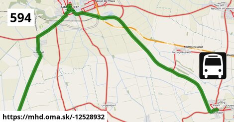
Cesta: OMA » Doprava » iná » bus » Bus 594: Kammersdorf Gemeindeamt = > Staatz Hauptstraße
Bus 594: Kammersdorf Gemeindeamt = > Staatz Hauptstraße
dĺžka 17 km , spravuje Dr. Richard NÖ, číslo trasy 594, názvy: Bus 594: Kammersdorf Gemeindeamt => Staatz Hauptstraße
Zastávky popri linke:
Hanfthal Ort po 3,2 km ¤, Hanfthal Ort po 3,2 km ¤, Laa an der Thaya Einkaufszentrum Thayapark po 4,4 km ¤, Laa an der Thaya Einkaufszentrum Thayapark po 4,4 km ¤, Laa an der Thaya Gymnasium po 5,7 km ¤, 1 po 6,0 km ¤, 2 po 6,0 km ¤, Laa an der Thaya Stadtfeldgasse po 6,7 km ¤, Laa an der Thaya Stadtfeldgasse po 6,8 km ¤, Laa an der Thaya Simon-Scheiner-Straße po 7,3 km ¤, Staatz Hauptstraße po 17 km ¤Má spoločné úseky s linkami:
Bus 588: Mistelbach Alleegasse = > Laa an der Thaya Gymnasium (über Hagenberg bei Staatz Volksschule) po 2,9 km ¤ , Bus 594: Kammersdorf Gemeindeamt = > Poysdorf Dreifaltigkeitsplatz po 4,8 km ¤ , Bus 593: Laa an der Thaya Kirchenplatz = > Hanfthal Ort po 4,8 km ¤ , Bus 813: Laa an der Thaya Therme = > Guntersdorf Bahnhof po 5,7 km ¤ , Bus 813: Laa an der Thaya Bahnhof = > Guntersdorf Bahnhof po 5,7 km ¤ , Bus 593: Laa an der Thaya Gymnasium = > Laa an der Thaya Bahnhof po 5,7 km ¤ , Bus 813: Laa an der Thaya Therme = > Hollabrunn Bahnhof po 5,7 km ¤ , Bus 593: Laa an der Thaya Kirchenplatz = > Hanfthal Ort (über Laa an der Thaya St.-Vitus-Heim) po 5,7 km ¤ , Bus 813: Laa an der Thaya Therme = > Alberndorf im Pulkautal Gemeindeamt po 5,7 km ¤ , Bus 813: Laa an der Thaya Therme = > Großkadolz Glockenturm po 5,7 km ¤ , Bus 813: Laa an der Thaya Bahnhof = > Untermarkersdorf Gasthaus Pulkautaler po 5,7 km ¤ , Bus 593: Laa an der Thaya Gymnasium = > Laa an der Thaya Kellerhügel po 5,7 km ¤ , Bus 813: Laa an der Thaya Bahnhof = > Hollabrunn Bahnhof (über Peigarten bei Haugsdorf Ortsmitte) po 5,7 km ¤ , Bus 813: Laa an der Thaya Bahnhof = > Hollabrunn Kirchenplatz po 5,7 km ¤ , Bus 588: Mistelbach Bahnhof = > Laa an der Thaya Stadtplatz (über Hagenberg bei Staatz Volksschule) po 5,7 km ¤ , Bus 813: Jetzelsdorf Kriegerdenkmal = > Laa an der Thaya Bahnhof (über Hadres Volksschule, Obritz Kirche, Mailberg Hauptplatz und Laa an der Thaya Kirchenplatz) po 5,7 km ¤ , Bus 588: Laa an der Thaya Bahnhof = > Mistelbach Bahnhof (über Laa an der Thaya Volksschule und Ungerndorf Kirche) po 5,7 km ¤ , Bus 813: Laa an der Thaya Stadtplatz = > Wulzeshofen Gemeindeamt po 5,9 km ¤ , Bus 591: Stronsdorf Hauptplatz = > Laa an der Thaya Kirchenplatz po 5,9 km ¤ , Bus 590: Laa an der Thaya Bahnhof = > Mistelbach Bahnhof (über Zwentendorf an der Zaya Ort) po 6,0 km ¤ , Bus 588: Mistelbach Bahnhof = > Laa an der Thaya Gymnasium (über Laa an der Thaya Volksschule) po 6,0 km ¤ , Bus 588: Laa an der Thaya Bahnhof = > Mistelbach Bahnhof (über Ungerndorf Kirche, nicht über Laa an der Thaya Gymnasium) po 6,0 km ¤ , Bus 591: Laa an der Thaya Bahnhof = > Großharras Gemeindeamt (über Ungerndorf) po 6,0 km ¤ , Bus 580: Poysdorf Dreifaltigkeitsplatz = > Laa/Thaya Gymnasium (beschleunigt) po 6,0 km ¤ , Bus 590: Laa an der Thaya Bahnhof = > Mistelbach Bahnhof po 6,0 km ¤ , Bus 588: Laa an der Thaya Bahnhof = > Mistelbach Bahnhof (über Ungerndorf Kirche und Frättingsdorf Ortsmitte, nicht über Laa an der Thaya Gymnasium) po 6,0 km ¤ , Bus 593: Laa an der Thaya St.-Vitus-Heim = > Laa an der Thaya Kellerhügel po 6,0 km ¤ , Bus 591: Laa an der Thaya Bahnhof = > Unterstinkenbrunn Stronsdorfer Straße (über Ungerndorf) po 6,0 km ¤ , Bus 582: Poysbrunn Feldstraße = > Laa an der Thaya Gymnasium po 6,0 km ¤ , Bus 593: Laa an der Thaya Kirchenplatz = > Laa an der Thaya Bahnhof po 6,0 km ¤ , Bus 585: Hausbrunn Friedhofstraße = > Laa an der Thaya Gymnasium po 6,0 km ¤ , Bus 591: Laa an der Thaya Bahnhof = > Stronsdorf Hauptplatz (über Ungerndorf) po 6,0 km ¤ , Bus 582: Laa an der Thaya Bahnhof = > Poysdorf Dreifaltigkeitsplatz po 6,0 km ¤ , Bus 590: Laa an der Thaya Bahnhof = > Mistelbach Bahnhof (über Hagendorf Fallbacher Straße und Zwentendorf an der Zaya Ort) po 6,0 km ¤ , Bus 588: Mistelbach Bahnhof = > Laa an der Thaya Stadtplatz (über Ernsdorf bei Staatz Kapellenstraße und Laa an der Thaya Volksschule) po 6,0 km ¤ , Bus 581: Laa an der Thaya Kirchenplatz = > Poysdorf Dreifaltigkeitsplatz (via Laa Gymnasium) po 6,0 km ¤ , Bus 591: Patzenthal Ortsmitte = > Laa an der Thaya Anton-Bruckner-Straße (über Ungerndorf Kirche) po 6,0 km ¤ , Bus 582: Laa an der Thaya Bahnhof = > Zlabern Antoniweg po 6,0 km ¤ , Bus 582: Schrattenberg Kirchenplatz = > Laa an der Thaya Gymnasium po 6,0 km ¤ , Bus 582: Laa an der Thaya Bahnhof = > Schrattenberg Kirchenplatz po 6,0 km ¤ , Bus 593: Laa an der Thaya St.-Vitus-Heim = > Laa an der Thaya Bahnhof po 6,0 km ¤ , Bus 583: Poysdorf Dreifaltigkeitsplatz = > Laa an der Thaya Stadtplatz po 6,0 km ¤ , Bus 582: Zlabern Antoniweg = > Laa an der Thaya Gymnasium po 6,0 km ¤ , Bus 580: Pottenhofen Ortsmitte = > Laa/Thaya Gymnasium po 6,0 km ¤ , Bus 580 Laa/Thaya Bahnhof = > Poysdorf Dreifaltigkeitsplatz (via Laa Kirchenplatz, Gymnasium) po 6,0 km ¤ , Bus 591: Laa an der Thaya Bahnhof = > Stronsdorf Hauptplatz (über Ungerndorf) po 6,0 km ¤ , Bus 593: Laa an der Thaya Vorgartenstraße = > Laa an der Thaya Gymnasium po 6,0 km ¤ , Bus 588: Laa an der Thaya Bahnhof = > Mistelbach Bahnhof (über Ungerndorf Kirche und Frättingsdorf Ortsmitte, nicht über Laa an der Thaya Gymnasium) po 6,0 km ¤ , Bus 590: Mistelbach Bahnhof = > Altmanns bei Mistelbach Ortsmitte = > Asparn/Zaya Schulzentrum = > Laa/Thaya Gymnasium po 6,0 km ¤ , Bus 588: Laa an der Thaya Bahnhof = > Mistelbach Bahnhof (über Laa an der Thaya Volksschule und Loosdorf bei Staatz Nr. 65) po 6,6 km ¤ , Bus 588: Laa an der Thaya Bahnhof = > Mistelbach Bahnhof (über Loosdorf bei Staatz Nr. 65) po 6,6 km ¤ , Bus 591: Patzenthal Ortsmitte = > Laa an der Thaya Anton-Bruckner-Straße po 6,6 km ¤ , Bus 591: Stronsdorf Hauptplatz = > Laa an der Thaya Bahnhof po 6,6 km ¤ , Bus 588: Laa an der Thaya Bahnhof = > Mistelbach Bahnhof po 6,6 km ¤ , Bus 588: Laa an der Thaya Bahnhof = > Mistelbach Bahnhof (über Laa an der Thaya Kirchenplatz und Loosdorf bei Staatz Nr. 65) po 6,6 km ¤ , Bus 591: Laa an der Thaya Bahnhof = > Patzenthal Ortsmitte po 6,6 km ¤ , Bus 591: Laa an der Thaya Simon-Scheiner-Straße = > Patzmannsdorf Ortsmitte po 6,6 km ¤ , Bus 813: Guntersdorf Bahnhof = > Laa an der Thaya Therme po 6,6 km ¤ , Bus 591: Zwingendorf Ortsmitte = > Laa an der Thaya Anton-Bruckner-Straße po 6,6 km ¤ , Bus 591: Laa an der Thaya Bahnhof = > Stronsdorf Hauptplatz (über Laa an der Thaya Volksschule und Kirchenplatz) po 6,6 km ¤ , Bus 584: Waltersdorf bei Staatz Ortsmitte = > Laa an der Thaya Gymnasium po 6,6 km ¤ , Bus 813: Guntersdorf Bahnhof = > Laa an der Thaya Bahnhof po 6,6 km ¤ , Bus 813: Guntersdorf Bahnhof = > Laa an der Thaya Therme (über Hanfthal Kirche) po 6,6 km ¤ , Bus 813: Hollabrunn Hauptplatz = > Laa an der Thaya Therme (über Guntersdorf Bahnhof) po 6,6 km ¤ , Bus 813: Jetzelsdorf Kriegerdenkmal = > Laa an der Thaya Bahnhof (über Mailberg Hauptplatz) po 6,6 km ¤ , Bus 813: Hollabrunn Hauptplatz = > Laa an der Thaya Therme po 6,6 km ¤ , Bus 813: Großkadolz Glockenturm = > Laa an der Thaya Bahnhof po 6,6 km ¤ , Bus 813: Jetzelsdorf Kriegerdenkmal = > Laa an der Thaya Bahnhof po 6,6 km ¤ , Bus 591: Laa an der Thaya Bahnhof = > Stronsdorf Hauptplatz po 6,6 km ¤ , Bus 591: Laa an der Thaya Bahnhof = > Stronsdorf Hauptplatz (über Laa an der Thaya Kirchenplatz) po 6,6 km ¤ , Bus 813: Hollabrunn Kirchenplatz = > Laa an der Thaya Therme po 6,6 km ¤ , Bus 588: Laa an der Thaya Bahnhof = > Mistelbach Bahnhof (über Laa an der Thaya Volksschule, Gaubitsch Ortsmitte, Loosdorf bei Staatz Nr. 65 und Mistelbach Alleegasse) po 6,6 km ¤ , Bus 813: Hollabrunn Hauptplatz = > Laa an der Thaya Therme po 6,6 km ¤ , Bus 591: Laa an der Thaya Bahnhof = > Großharras Gemeindeamt po 6,6 km ¤ , Bus 580 Laa/Thaya Stadtplatz = > Poysdorf Dreifaltigkeitsplatz po 6,6 km ¤ , Bus 580 Laa/Thaya Stadtplatz = > Poysdorf Dreifaltigkeitsplatz (Wochenendfahrten) po 6,6 km ¤ , Bus 583: Laa an der Thaya Gymnasium = > Poysdorf Dreifaltigkeitsplatz po 6,6 km ¤ , Bus 582: Poysdorf Mittelschule = > Laa an der Thaya Stadtplatz po 6,6 km ¤ , Bus 581: Poysdorf Mittelschule = > Laa Stadtplatz po 6,6 km ¤ , Bus 581: Poysdorf Volksschule = > Laa Stadtplatz po 6,6 km ¤ , Bus 588: Mistelbach Bahnhof = > Laa an der Thaya Stadtplatz (über Ungerndorf Kirche) po 6,6 km ¤ , Bus 585: Hausbrunn Friedhofstraße = > Laa an der Thaya Gymnasium po 6,6 km ¤ , Bus 582: Poysdorf Volksschule = > Laa an der Thaya Stadtplatz po 6,6 km ¤ , Bus 580: Poysdorf Dreifaltigkeitsplatz = > Laa/Thaya Stadtplatz po 6,6 km ¤ , Bus 581: Laa/Thaya Stadtplatz = > Poysdorf Dreifaltigkeitsplatz po 6,6 km ¤ , Bus 582: Laa an der Thaya Stadtplatz = > Poysdorf Dreifaltigkeitsplatz po 6,6 km ¤ , Bus 580: Poysdorf Dreifaltigkeitsplatz = > Laa/Thaya Stadtplatz (Wochenendfahrten) po 6,6 km ¤ , Bus 595: Wien Opelwerk = > Laa an der Thaya Stadtplatz po 6,6 km ¤ , Bus 581: Poysdorf Dreifaltigkeitsplatz = > Laa Stadtplatz po 6,6 km ¤ , Bus 582: Poysdorf Dreifaltigkeitsplatz = > Laa an der Thaya Stadtplatz po 6,6 km ¤ , Bus 593: Laa an der Thaya Kirchenplatz = > Laa an der Thaya Stadtplatz (über Laa an der Thaya Vorgartenstraße) po 6,6 km ¤ , Bus 582: Laa an der Thaya Stadtplatz = > Poysdorf Mittelschule po 6,6 km ¤ , Bus 590: Mistelbach Alleegasse = > Laa/Thaya Stadtplatz po 6,6 km ¤ , Bus 588: Mistelbach Bahnhof = > Unterstinkenbrunn Stronsdorfer Straße = > Laa an der Thaya Stadtplatz po 6,6 km ¤ , Bus 580: Poysdorf Mittelschule = > Laa/Thaya Stadtplatz po 6,6 km ¤ , Bus 593: Laa an der Thaya Kirchenplatz = > Laa an der Thaya Stadtplatz po 6,6 km ¤ , Bus 595: Laa an der Thaya Stadtplatz = > Wien Opelwerk po 6,6 km ¤ , Bus 104 po 6,6 km ¤ , Bus 591: Stronsdorf Hauptplatz = > Laa an der Thaya Stadtplatz (über Ungerndorf Kirche) po 6,6 km ¤ , Bus 590: Mistelbach Bahnhof = > Laa/Thaya Stadtplatz po 6,6 km ¤ , Bus 590: Laa an der Thaya Kirchenplatz = > Mistelbach Bahnhof (über Hagendorf Fallbacher Straße und Zwentendorf an der Zaya Ort) po 6,6 km ¤ , Bus 593: Laa an der Thaya Bahnhof = > Laa an der Thaya Gymnasium po 6,9 km ¤ , Bus 591: Stronsdorf Hauptplatz = > Laa an der Thaya Bahnhof (nicht über Laa an der Thaya Stadtplatz) po 6,9 km ¤ , Bus 591: Großharras Gemeindeamt = > Laa an der Thaya Bahnhof (über Ungerndorf Kirche) po 7,2 km ¤ , Bus 584: Laa an der Thaya Bahnhof = > Ameis Kirche po 10,1 km ¤ , Bus 583: Laa an der Thaya Stadtplatz = > Poysdorf Dreifaltigkeitsplatz po 10,1 km ¤ , Bus 583: Walterskirchen Großkruter Straße = > Laa an der Thaya Gymnasium po 10,1 km ¤ , Bus 583: Poysdorf Dreifaltigkeitsplatz = > Laa an der Thaya Gymnasium (über Staatz Burgring/Schulen) po 10,1 km ¤ , Bus 588: Laa an der Thaya Gymnasium = > Mistelbach Bahnhof (Direktkurs) po 16 km ¤ , Bus 588: Mistelbach Bahnhof = > Laa an der Thaya Stadtplatz (über Ernsdorf bei Staatz Kapellenstraße und Hagendorf Kirche) po 17 km ¤ , Bus 588: Mistelbach Alleegasse = > Laa an der Thaya Stadtplatz (über Frättingsdorf Kirche, Ernsdorf bei Staatz Kapellenstraße und Hagendorf Kirche) po 17 km ¤ , Bus 588: Laa an der Thaya Kirchenplatz = > Mistelbach Bahnhof (über Loosdorf bei Staatz Nr. 65 und Hagenberg bei Staatz Volksschule) po 17 km ¤ , Bus 588: Mistelbach Bahnhof = > Laa an der Thaya Stadtplatz (über Ernsdorf bei Staatz Kapellenstraße) po 17 km ¤ , Bus 586: Gaubitsch Ortsmitte = > Frättingsdorf Bahnhof po 17 km ¤ , Bus 583: Frättingsdorf Bahnhof = > Poysdorf Dreifaltigkeitsplatz po 17 km ¤ , Bus 586: Frättingsdorf Bahnhof = > Gaubitsch Ortsmitte po 17 km ¤ , Bus 583: Ameis Kirche = > Frättingsdorf Bahnhof po 17 km ¤ , Bus 594: Poysdorf Dreifaltigkeitsplatz = > Stronsdorf Hauptplatz po 17 km ¤ , Bus 586: Frättingsdorf Bahnhof = > Hagendorf Kirche po 17 km ¤ , Bus 586: Hagendorf Kirche = > Frättingsdorf Bahnhof po 17 km ¤ , Bus 588: Wultendorf bei Staatz Siedlung = > Mistelbach Bahnhof po 17 km ¤ , Bus 584: Staatz Burgring/Schulen = > Wultendorf bei Staatz Siedlung po 17 km ¤Trasa vedie cez obce
Gemeinde Laa an der Thaya: 11,6 km (69.1 %), Gemeinde Staatz: 3,6 km (21.3 %), Gemeinde Unterstinkenbrunn: 1,54 km (9.1 %),Podobné linky 594:
ine: Bus 594: Poysdorf Dreifaltigkeitsplatz = > Stronsdorf Hauptplatz, , ine: Bus 594: Kammersdorf Gemeindeamt = > Poysdorf Dreifaltigkeitsplatz,Viac info: aktualizovať mapu, uprav v JOSM (pokročilé), -12528932, stiahni GPX, najbližšia MHD, route: bus, to: Staatz Hauptstraße, from: Kammersdorf Gemeindeamt, network: VOR, osm uid: 0, route name: Bus 594: Kammersdorf Gemeindeamt => Staatz Hauptstraße, osm version: 10, osm changeset: 0, osm timestamp: 2023 08 30T05:22:05Z, Q2516485, 2, dlzka: 16831, pocet seg: 1, lon: 16.4106, lat: 48.7008, povodna farba: dr. richard no,
Podpor projekt OMA:
Spojte sa s nami na facebooku, zdieľajte túto stránku na Facebooku, na Twittri, alebo umiestnite odkaz na svoju stránku.
Ale hlavne doplňte dáta do Openstreetmap, články do wikipédie, ...