prestupné linky:
Bus 886: Drosendorf Schulen = > Goggitsch Ortsmitte po 1,98 km ¤, Bus 886: Drosendorf Schulen = > Zissersdorf bei Geras Ortsmitte po 1,98 km ¤, Bus 875: Retz Bahnhof = > Merkersdorf/Hardegg Ortsmitte = > Drosendorf Schulen po 1,98 km ¤, Bus 875: Retz Bahnhof = > Drosendorf Schulen po 1,98 km ¤, Bus 875: Retz Bahnhof = > Hardegg Burg = > Drosendorf Schulen po 1,98 km ¤, Bus 875: Drosendorf Schulen = > Retz Bahnhof po 1,98 km ¤, Bus 875: Drosendorf Schulen = > Hardegg Burg = > Retz Bahnhof po 1,98 km ¤Má spoločné úseky s linkami:
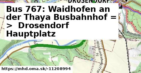
Bus 767: Drosendorf Schulen = > Waidhofen an der Thaya Busbahnhof po 1,83 km ¤ , Bus 886: Horn Bahnhof = > Drosendorf Schulen po 1,98 km ¤ , Bus 886: Horn Hauptplatz = > Drosendorf Schulen (alle Stationen) po 1,98 km ¤ , Bus 886: Horn Bahnhof = > Drosendorf Schulen (über Dallein Kapelle, nicht über Oberhöflein bei Geras Schloss) po 1,98 km ¤ , Bus 886: Horn Bahnhof = > Drosendorf Schulen (nicht über Dallein Kapelle, Oberhöflein bei Geras Schloss) po 1,98 km ¤ , Bus 886: Horn Hauptplatz = > Drosendorf Schulen (nicht über Dallein Kapelle, Oberhöflein bei Geras Schloss und Wolfsbach bei Drosendorf Ort) po 1,98 km ¤ , Bus 886: Drosendorf Schulen = > Horn Hauptplatz po 1,98 km ¤ , Bus 886: Drosendorf Schulen = > Wolfsbach bei Drosendorf Ort = > Kottaun Ortsmitte = > Dallein Kapelle = > Horn Bahnhof po 1,98 km ¤ , Bus 886: Drosendorf Schulen = > Wolfsbach bei Drosendorf Ort = > Horn Bahnhof po 1,98 km ¤ , Bus 886: Drosendorf Schulen = > Geras Berufsschule = > Horn Bahnhof po 1,98 km ¤ , Bus 886: Drosendorf Schulen = > Horn Bahnhof po 1,98 km ¤ , Bus 886: Drosendorf Schulen = > Hötzelsdorf-Geras Bahnhof po 1,98 km ¤ , Bus 886: Horn Bahnhof = > Horn Stadtsee = > Drosendorf Schulen po 1,98 km ¤ , Bus 816 po 1,98 km ¤Viac info: aktualizovať mapu, uprav v JOSM (pokročilé), -11208994, stiahni GPX, route: bus, to: Drosendorf Schulen, from: Waidhofen an der Thaya Busbahnhof, network: VOR, duration: 42, route name: Bus 767: Waidhofen an der Thaya Busbahnhof => Drosendorf Schulen, osm version: 28, osm changeset: 0, osm timestamp: 2025 04 10T14:46:08Z, Q2516485, 2, dlzka: 1980, pocet seg: 1, lon: 15.6140, lat: 48.8610, povodna farba: osterreichische postbus a,


